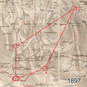
First Orienteering Event 1897
Orienteering is an activity sport which combines running/ walking whilst navigating a course using a detailed map. Anyone interested in outdoor activities should give it a go at some stage,…

Cartography & Publishing
Orienteering is an activity sport which combines running/ walking whilst navigating a course using a detailed map. Anyone interested in outdoor activities should give it a go at some stage,…
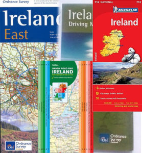
I was an agent for Ordnance Survey Ireland tourism & leisure maps in the early 2000s. The biggest sellers were Ireland road maps of which OSi had several flavours, plus…

The 1st March past saw an increase in postage charges from An Post. Earlier in the year, these were flagged as only affecting the cost of a normal letter stamp.…
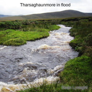
The crossing of streams and rivers is arguably the most common objective hazard faced by Irish hill walkers. Often pleasant & good fun to boulder hop in dry conditions, challenging…
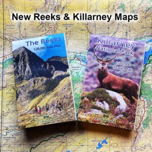
Spring is coming in, the mountains and glens are calling and I wish to advise that our two new maps for The Reeks and Killarney National Park are now available.…
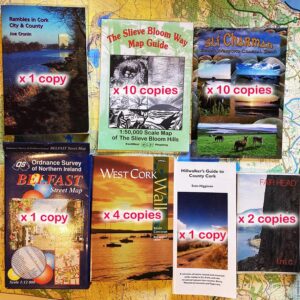
Before we started publishing more of our own maps, I used to sell other publishers guidebooks and maps. Sorting through boxes here and find I have the following copies of…
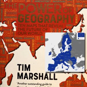
Being someone who compiles and publishes maps, I’d have an interest in many associated aspects including geography & history. Our son gave me a copy of ‘The Power of Geography’…
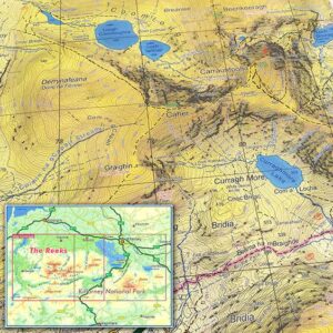
The Reeks and Killarney National Park We have just completed two new detailed topographic maps for The Reeks and Killarney National Park in Co.Kerry. These have been prepared to our…
If you ran the IMRA (Irish Mountain Running Association) Wicklow Way Half Marathon last Sunday, you should have received one of these unique buffs/ snoods as a reward for your…
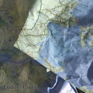
Photo here is of some ‘scrap’ Achill & Corraun maps which are printed on Enduro paper. We used them as floor protection when painting walls recently and they were then…