Changing Landscapes ~ Kippure Estate
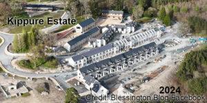
Changing Landscapes ~ Kippure EstateI posted a map update to Kippure Estate in Wicklow recently based on recreation developments of a few years ago. This same venue Kippure Estate/ Kippure…

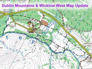
Dublin Mountains Map
Changing Landscapes ~ Kippure EstateI posted a map update to Kippure Estate in Wicklow recently based on recreation developments of a few years ago. This same venue Kippure Estate/ Kippure…
Kippure Estate UpdateTim & Della Kyne developed Kippure House into an adventure/ event/ conference centre back in the early 2000s. Called Kippure Estate it offered school tours, corporate days out,…

JB Malone and the Evening Herald (John Bernard) JB Malone (1913-89) was a prolific writer and promoter of hillwalking from the 1930s through to the 1970s. He did much for…
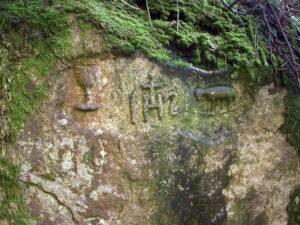
Mass rock in Glencree This large two metre high granite rock with religious carvings lies on the west bank of the Askabawn Stream that runs into the Glencree River. It…
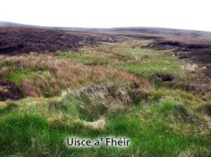
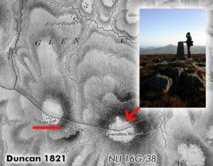
Uisce a’ Fhéir Uisce a’ Fhéir is the name of a stream on the south side of Kippure, draining to the Liffey. So reported Eugene Curry for the Ordnance Survey…
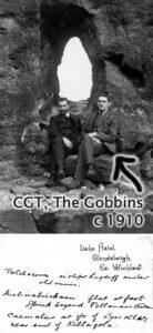
Charles Thompson (CGT) - science teacher, mountaineer and collector of place names A good number of placenames in Wicklow have been added to our maps in the past year. Some…
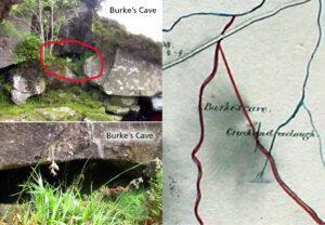
Burke's Cave One of the interesting aspects of examining old maps is that they often show long gone features from the past, particularly in urban areas. However due to the…
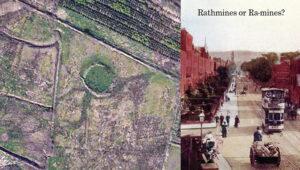
Raths and Raws The rath or ringfort is a ubiquitous feature in the Irish landscape - there are thought to be 40,000 plus sites. These circular enclosures were used as…
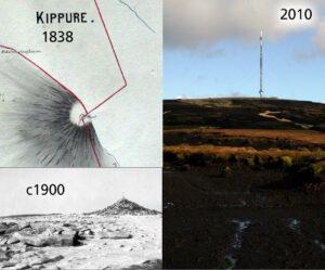
Kippure - The Pole Kippure is a townland and also the name given to the highest mountain in Co.Dublin at 757 metres in altitude. Straddling the Dublin/Wicklow border, it is…
The curious case of Prince William's Seat or Clusnaspeire Prince William's Seat is the Ordnance Survey name for the hill of 555 metres in height on the Dublin & Wicklow…