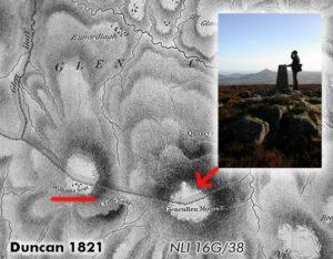
Gala Rock
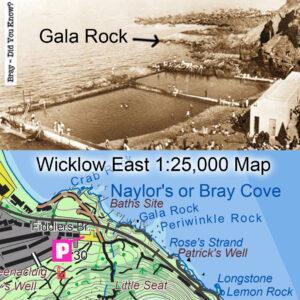
Gala RockThe local placename Gala Rock came to my attention a couple of years ago, but with no exact location, just that it was near Bray. Local man Maurice O’B…

Wicklow East Map
Gala RockThe local placename Gala Rock came to my attention a couple of years ago, but with no exact location, just that it was near Bray. Local man Maurice O’B…
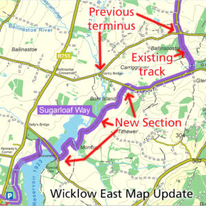
Sugarloaf Way Update Map update for our Wicklow East 1:25,000 print map. The Wicklow Way is a popular signposted walking trail and there have been moves afoot for many years…
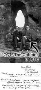
Charles Thompson (CGT) - science teacher, mountaineer and collector of place names A good number of placenames in Wicklow have been added to our maps in the past year. Some…
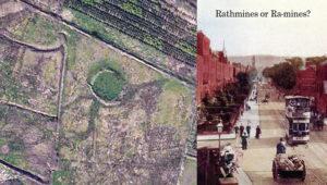
Raths and Raws The rath or ringfort is a ubiquitous feature in the Irish landscape - there are thought to be 40,000 plus sites. These circular enclosures were used as…
The curious case of Prince William's Seat or Clusnaspeire Prince William's Seat is the Ordnance Survey name for the hill of 555 metres in height on the Dublin & Wicklow…
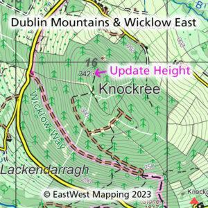
Knockree Update Thanks to map user Chris Crocker who has pointed out an error at Knockree on our Dublin Mountains and Wicklow East print maps and current digital map. Chris…
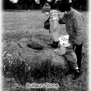
Bullaun Stones, often pronounced bull-yawn, are common enough field monuments found particularly along the east coast and hinterlands. Often of granite rock with a pronounced unnatural hole or depression in…
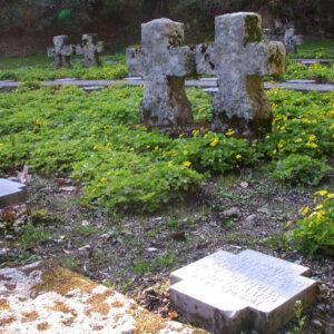
The German War Cemetery is located in an old quarry near the Glencree Centre at the top of the Glencree valley in Co.Wicklow. If you’re passing by, it’s well worth…
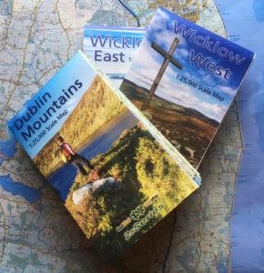
Three New 1:25,000 scale detailed maps are now available for the Dublin Mountains, Wicklow West and Wicklow East. It may have taken five years with lots of hiccups and hard…
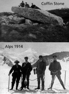
Today’s Charles Thompson images are the Coffin Stone on the western flanks of Djouce – note the old posts of a Powerscourt deer fence running behind. You can still find…