New Kerry Maps on the Way
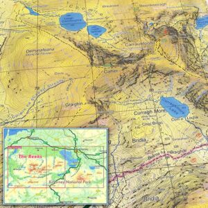
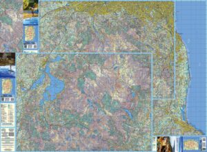
The Reeks and Killarney National Park We have just completed two new detailed topographic maps for The Reeks and Killarney National Park in Co.Kerry. These have been prepared to our…

Cartography & Publishing
The Reeks and Killarney National Park We have just completed two new detailed topographic maps for The Reeks and Killarney National Park in Co.Kerry. These have been prepared to our…
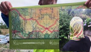
If you ran the IMRA (Irish Mountain Running Association) Wicklow Way Half Marathon last Sunday, you should have received one of these unique buffs/ snoods as a reward for your…
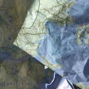
Photo here is of some ‘scrap’ Achill & Corraun maps which are printed on Enduro paper. We used them as floor protection when painting walls recently and they were then…
In recent years Ireland has experienced a steady increase in the number of people seeking out the benefits of outdoor exercise. Good for both mind and body. Associated with this…
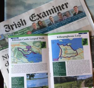
Purchase the Irish Examiner this past weekend and for the next two weeks and you’ll get a walking trail supplement. Entitled 100 Irish Trails, this is published in association with…
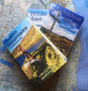
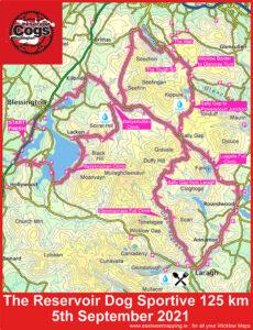
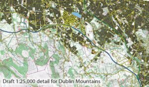
Three New 1:25,000 scale detailed maps are now available for the Dublin Mountains, Wicklow West and Wicklow East. It may have taken five years with lots of hiccups and hard…
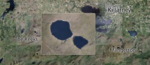
Cleared the decks temporarily and making a start on plotting draft detail for parts of Kerry. In this case, two maps of The Reeks and Mangerton, overlapping around the Gap…
Our three new 1:25000 scale maps for the northern Dublin & Wicklow mountains have gone to proofing stage with the printer. These are prepared to our 25Series standard with 5…
This is to advise that steady progress is being made on three new map sheets covering the North Wicklow region. These are being prepared to our 25Series standard with a…

The Galtee Mountains have plainly been a busy place this past year, notwithstanding travel restrictions and lockdowns. This is evident from the Ireland Walking Awards run by Kieron Gribbon in…