Orienteering is an activity sport which combines running/ walking whilst navigating a course using a detailed map. Anyone interested in outdoor activities should give it a go at some stage, not least to improve your fine map reading skills & fitness. Orienteering as a sport can be highly competitive but it also caters for general recreational and family activity. You can find out more about the sport in Ireland at www.orienteering.ie
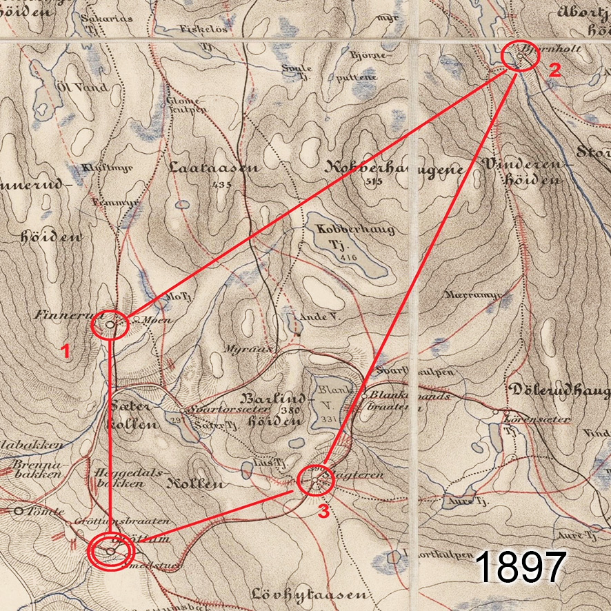
The map here though is a much simpler affair and was used for the first civilian orienteering competition in 1897, was sponsored by the Tjalve Sports Club and held near Oslo. The course was 19.5 Km long with only three controls and Peder Fossum won the race with a time of 1 hour, 47 minutes and 7 seconds.
Modern orienteering maps are a lot more detailed and colourful but the essentials of the sport remain the exact same. Finding your way across often unfamiliar ground, choosing the best route and locating those pesky control points.
#eastwestmapping #orienteeringireland