Jamesie’s Well & Leana Loops
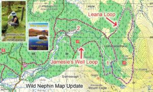
Jamesie’s Well & Leana LoopsIf you have a copy of our Wild Nephin 1:25,000 scale map, take note of this update. Two new loop walks have been developed by the…

Map Updates
Jamesie’s Well & Leana LoopsIf you have a copy of our Wild Nephin 1:25,000 scale map, take note of this update. Two new loop walks have been developed by the…
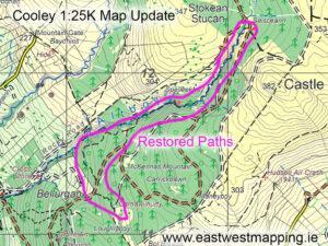
Cooley Map Update ~ Foyles WayThe Cooley region of Louth was badly affected by heavy rain and floods at the end of October, damaging several roads and flooding property. Foyles…
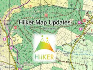
Hiiker Map UpdatesMaps from EastWest Mapping are found on the Hiiker phone app. Here we make annual updates around this time. By contrast updates don't appear in print for several…
Blessington eGreenwayThe Blessington eGreenway proposal is back on track, new plans are viewable on the Wicklow County Council website and all is to go before An Bord Pleanála.Poulaphuca Reservoir was…
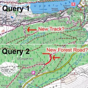
Map Update QueriesI’m currently making a round of updates to our mapping. Have a couple of queries which users may be able to shed light on. These are in relation…
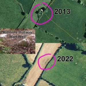
Changing Landscapes ~ Killinure Wart WellI first surveyed our Blackstairs & Mount Leinster map over 2012-13 and am currently recompiling the whole map from scratch to bring it to the…
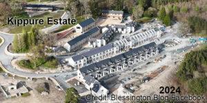
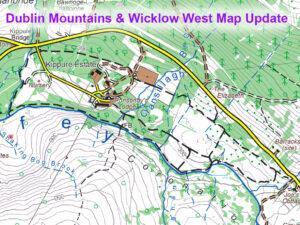
Changing Landscapes ~ Kippure EstateI posted a map update to Kippure Estate in Wicklow recently based on recreation developments of a few years ago. This same venue Kippure Estate/ Kippure…
Kippure Estate UpdateTim & Della Kyne developed Kippure House into an adventure/ event/ conference centre back in the early 2000s. Called Kippure Estate it offered school tours, corporate days out,…
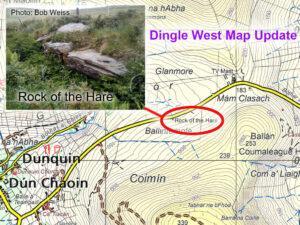
Rock of the Hare ~ Dingle West MapThanks to Bob Weiss for photo and information on this road side rock, apparently called the Rock of the Hare. It lies on…
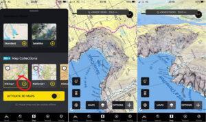
Hiiker App UpdateMaps from EastWest Mapping are found on the Irish developed Hiiker phone app. You need a PRO+ subscription which also gives access to full OSi mapping and many…