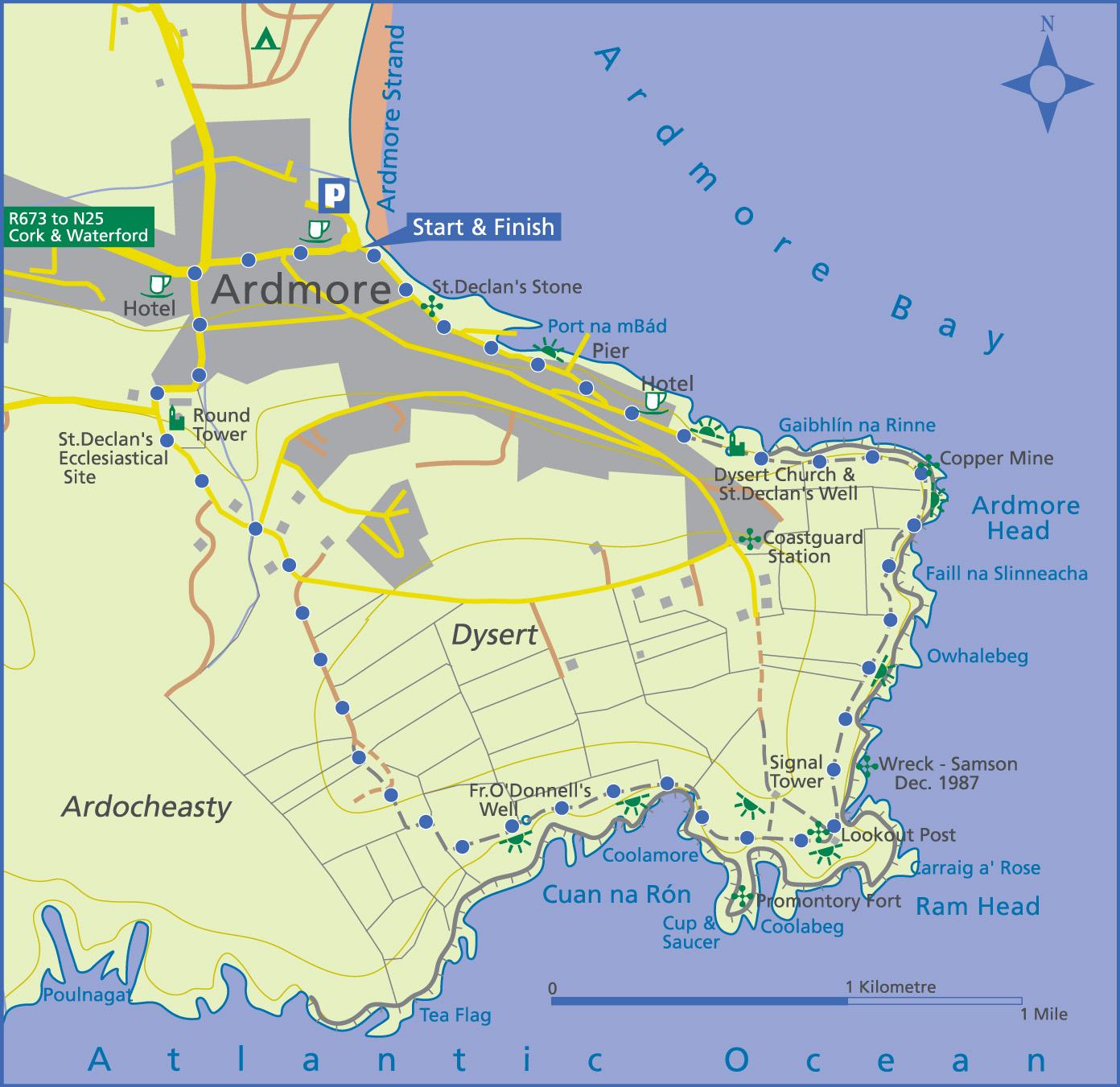
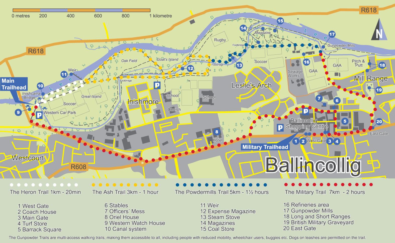
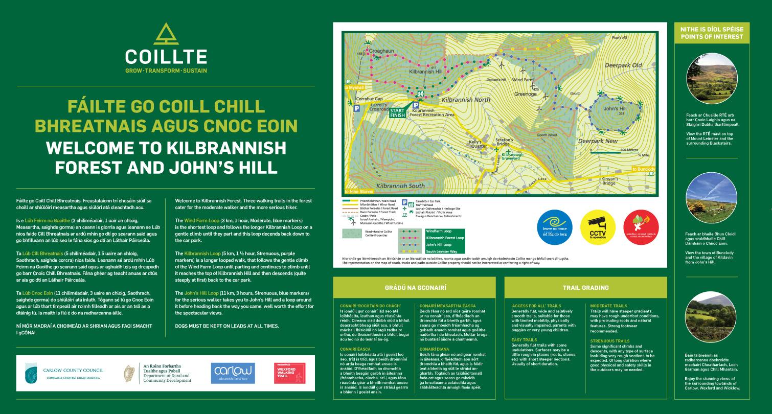
We produce a variety of mapping solutions for the local authority and tourism sectors. Typically these consist of the production & supply of an accurate map with trails marked, supplied in pdf format. These are then frequently incorporated into public signage information boards and/or made available to the public as downloadable pdf files which the public can print off for themselves. Clients include local authorities in Carlow, Wexford, Waterford, Wicklow, Kilkenny, Laois, Offaly, Clare, Cork, Tipperary, Leitrim, Mayo, Galway & Sligo. Several state bodies such as Coillte & the National Trails Office avail of our mapping services as well as many local tourism development groups.
Since the accuracy of map & trail detail is a feature of our maps, generally a survey visit is made to the site to walk and/or cycle trails and ensure that the map detail is of good quality. Please see below for examples of various solutions and contact us to discuss your individual requirements.
Get in Touch
Contact us today for any inquiries by simply filling out details. We will get back as soon as possible.