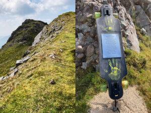
Hut Sites & Sheep Pens
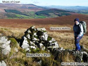
Hut Sites & Sheep PensThis is Blanche’s Pen, a small sheep pen or ‘pin’ used in the past by local hill farmers to gather a few ewes in, so one…

Placenames & Heritage Notes
Hut Sites & Sheep PensThis is Blanche’s Pen, a small sheep pen or ‘pin’ used in the past by local hill farmers to gather a few ewes in, so one…
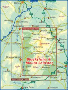
Blackstairs & Mount Leinster 2024 to printOur Blackstairs, Mount Leinster & The Barrow Valley 1:25,000 scale map published in 2013 went out of print early this year – so eleven…
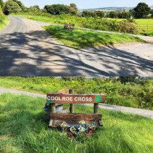
CrossesPictured here is Coolroe Cross where the word ‘Cross’ is a common term in rural Ireland for any meeting of roads. Coolroe Cross is a ‘three way’ cross i.e. a…
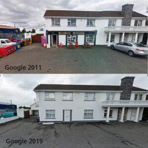
Rural ShopsThe cartographer has to investigate many aspects of a region in order to compile both a useful map and a portrait of the area. Many little small details as…
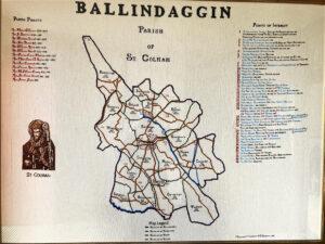
BallindagginI was down in Ballindaggin area of North Wexford there last week, gathering a few placenames and sites of interest with particular thanks to folklore.ie for assistance. It was mentioned…
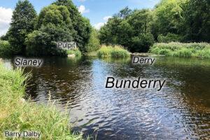
BunderryThe name Bunderye is listed in the Civil Survey of Wexford of 1654-56, it’s a place along the barony and county bounds and listed in the description of same.Here it…
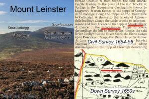
Map & Written RecordsMaps that define land divisions are long the norm but these replaced an older tradition of describing territory with a written description of it’s boundaries using landmarks.…
MemorialsI have mixed opinions regarding personal memorials on the Irish uplands. After all many of our heights are crowned with great cairns laboriously built to commemorate some ancient king or…
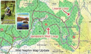
Jamesie’s Well & Leana LoopsIf you have a copy of our Wild Nephin 1:25,000 scale map, take note of this update. Two new loop walks are being developed by the…
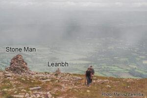
Stone Man ~ GalteesThe Stone Man and his smaller neighbour, An Leanbh ~ the child pictured here on the broad spur called Munaleathan that descends in a northerly direction from…