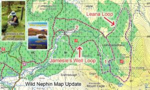
Jamesie’s Well & Leana Loops
Jamesie’s Well & Leana LoopsIf you have a copy of our Wild Nephin 1:25,000 scale map, take note of this update. Two new loop walks have been developed by the…

Jamesie’s Well & Leana LoopsIf you have a copy of our Wild Nephin 1:25,000 scale map, take note of this update. Two new loop walks have been developed by the…
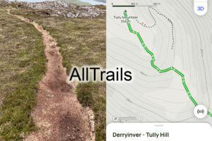
AllTrailsTraditionally casual walkers looking for walks would have bought a guidebook and map. This market has largely been transformed in recent years by phone apps. There’s a choice of such…
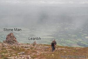
Stone Man ~ GalteesThe Stone Man and his smaller neighbour, An Leanbh ~ the child pictured here on the broad spur called Munaleathan that descends in a northerly direction from…
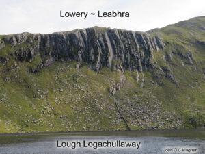
Lowery ~ LeabhraThe geology of south Mayo is complex with a mixture of Carboniferous limestone, igneous rocks of granite & gabbro and Ordovician sedimentary rocks. The latter slates & sandstones…
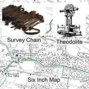
Ordnance Survey Bi CentenaryThe 21st June 2024 just past marks the bi centenary of the publication of the Spring Rice Report which set up what became two important bodies 1)…
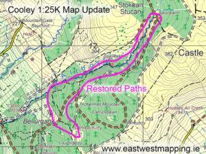
Cooley Map Update ~ Foyles WayThe Cooley region of Louth was badly affected by heavy rain and floods at the end of October, damaging several roads and flooding property. Foyles…
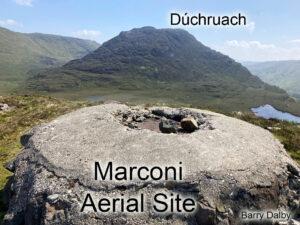
Marconi Aerial SitesMany visitors to Conamara will be familiar with the Marconi station at Derrygimlagh near Clifden which is now promoted as a visitor attraction. Those willing to take on…
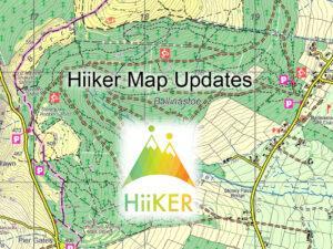
Hiiker Map UpdatesMaps from EastWest Mapping are found on the Hiiker phone app. Here we make annual updates around this time. By contrast updates don't appear in print for several…
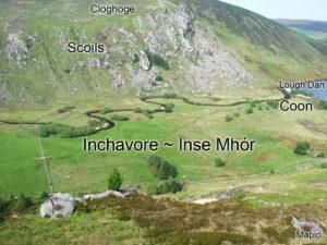
Inchavore ~ Inse MhórLough Dan is a popular place to visit in Wicklow. You need to walk in, either from the Pier Gates on the Roundwood side or from the…
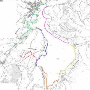
Blessington eGreenwayThe Blessington eGreenway proposal is back on track, new plans are viewable on the Wicklow County Council website and all is to go before An Bord Pleanála.Poulaphuca Reservoir was…