Stone Man ~ Galtees
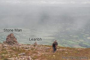
Stone Man ~ GalteesThe Stone Man and his smaller neighbour, An Leanbh ~ the child pictured here on the broad spur called Munaleathan that descends in a northerly direction from…

Galtee Map
Stone Man ~ GalteesThe Stone Man and his smaller neighbour, An Leanbh ~ the child pictured here on the broad spur called Munaleathan that descends in a northerly direction from…
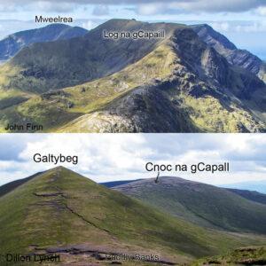
Horsey HillnamesCapall - one of the Irish words for a horse crops up quite frequently in our placenames. No doubt but that in some places, it literally means a place…
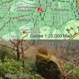
Moore’s Table UpdateThanks to Jimmy Barry for sending on a photo and location update for a large rock and viewpoint called Moore’s Rock. This is located in the Bansha Woods…
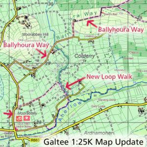
Galtee Map Update ~ Ballyhoura Way If you have a copy of our 1:25,000 scale map of the Galtees, see the map extract here for details of a change to…
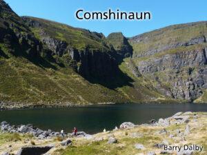
Coms Coums Corries & Kyas Those who walk the Irish uplands will be familiar with bowl like lakes nestling into the slopes under the peaks. Often backed by cliffs, the…
Galtee Challenge Walk 2023 The annual Galtee Challenge Walk is coming up Saturday 24th June. The full route is 31 kilometres starting Cahir and walking the ridge to end at…

I’m plotting map detail down Dingle way these days and it’s notable how many ráths and caiseals, earthen and stone banked ringforts are still extant. There are cases where all…
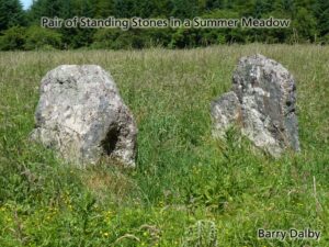
This photo was taken in the mighty summer of 2018: a pair of standing stones set in a rich summer meadow. I like it firstly because it’s the small details…
The Galtee Mountains have plainly been a busy place this past year, notwithstanding travel restrictions and lockdowns. This is evident from the Ireland Walking Awards run by Kieron Gribbon in…
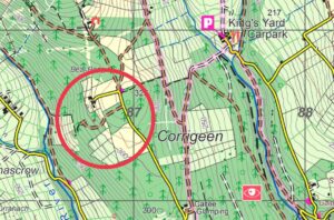
Many thanks to Maureen O'Brien for spotting and sending on details of this new forest road construction in the Galty Castle/ Corrigeen area of our Galtee 1:25,000 map. Probably been…