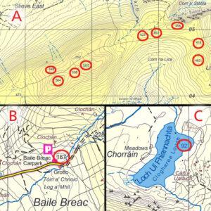
Spot Heights
Inserting spot heights is a stage in map production, these are measured from a digital surface model with an accuracy of +/- 0.5 metre on open terrain. Spot heights are…

Cartography, Map Design & Publishing
Inserting spot heights is a stage in map production, these are measured from a digital surface model with an accuracy of +/- 0.5 metre on open terrain. Spot heights are…
The one kilometre square grid used on EastWest Mapping maps is based on Irish Grid, one of our two national grid projections. This came to be used on Irish maps…
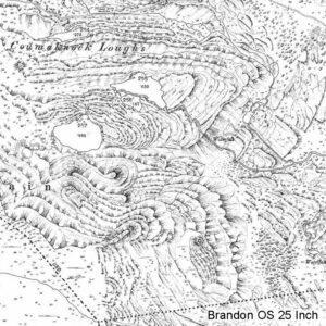
Brandon OS 25 Inch This extraordinary piece of cartography comes from the Ordnance Survey 25 Inch or 1:2500 scale series compiled in the late 19th & early 20th century. It…
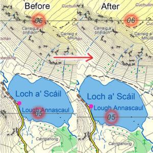
Contouring on recent EastWest Mapping maps is typically at a 5 metre interval and derived from digital terrain models supplied by Bluesky Ireland. You can think of these models like…
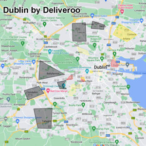
I came across this interesting & practical use of internet mapping there recently. It’s an unofficial kind of mapping layer passed around among Deliveroo riders in Dublin. So they have…
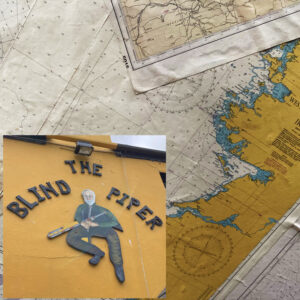
If you’re ever down in Caherdaniel in the Kingdom of Kerry and have a thirst on you, you’ll do worse than to drop into the Blind Piper for a pint…
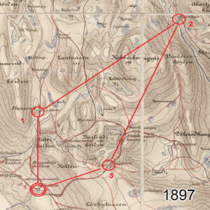
Orienteering is an activity sport which combines running/ walking whilst navigating a course using a detailed map. Anyone interested in outdoor activities should give it a go at some stage,…
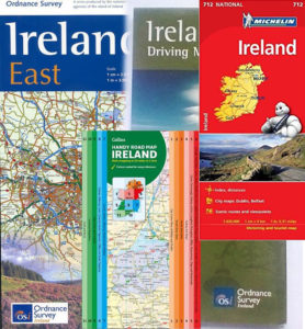
I was an agent for Ordnance Survey Ireland tourism & leisure maps in the early 2000s. The biggest sellers were Ireland road maps of which OSi had several flavours, plus…
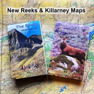
Our new detailed maps for The Reeks and Killarney are available online from EastWest Mapping. But for those who’d like to pick up a copy locally, here is a list…

Making slow progress on our Dingle mapping project but will get there in the end. Plan is to compile our 25Series map detail for the full peninsula from the Blaskets…