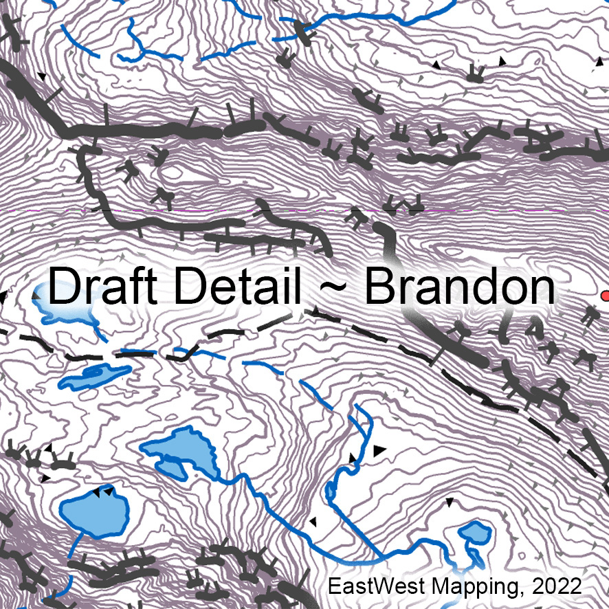
Making slow progress on our Dingle mapping project but will get there in the end. Plan is to compile our 25Series map detail for the full peninsula from the Blaskets to Tralee. This will yield a detailed print map at 1:20,000 of the Brandon area, two 1:40,000 scale maps with 10 metre contours of the whole peninsula and a full digital map to our 25 Series standard. The map detail will overlap with our Reeks map published earlier this year.
It’s a big project and I’m still working through the detail plot but hopefully will finish this and get through the field and other work over the summer with a view to publishing in the late autumn.
Here is some draft detail to whet the appetite. Apart from the complex hill terrain, it’s notable just how many clusters of hut sites and clocháns have survived here. Also notable are the many holiday houses, both one offs and in clusters. #eastwestmapping #dingle