Contouring on recent EastWest Mapping maps is typically at a 5 metre interval and derived from digital terrain models supplied by Bluesky Ireland. You can think of these models like the landscapes you see in 3D gaming, except they represent the real world surface. This data is collected by sensor from a survey plane and the accuracy of the elevation of any point on open ground is given as +/- 0.5 metre.
Apart from deriving contours from this data, we also measure & plot spot heights at useful places. Typically hill summits but also breaks in slope, in saddles or cols and at popular starting points like car parks. Thus the user on popular routes can subtract the figures, rather than counting many contours, in order to calculate height gain.
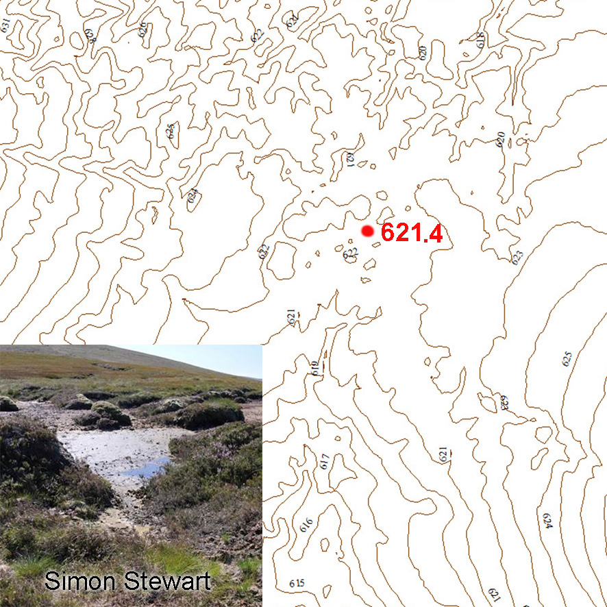
Sometimes the data is also useful to figure out lists of highest hills etc. In this image here, MountainViews were interested in the spot height of the saddle between Seefingan & Kippure. This complex area of gullies and peat hags has been contoured with Bluesky data to a 1 metre interval. You can see the outlines of several of the peat hags and Simon’s photo here shows the situation. The Bluesky model indicated a reading of 621.37 metres at the most likely point. Simon by way of verification climbed to the saddle and measured with a Trimble GPS with an accuracy of +/- 0.1 metre. His reading for the most likely point in the saddle near this was 621.45 metres.
This is at a level of detail far beyond the needs of the average map user but it does give a good idea of the quality of the contouring and height information on these maps.
#eastwestmapping