IMRA Buff
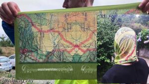
If you ran the IMRA (Irish Mountain Running Association) Wicklow Way Half Marathon last Sunday, you should have received one of these unique buffs/ snoods as a reward for your…

Cartography, Map Design & Publishing
If you ran the IMRA (Irish Mountain Running Association) Wicklow Way Half Marathon last Sunday, you should have received one of these unique buffs/ snoods as a reward for your…
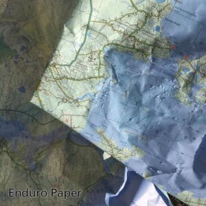
Photo here is of some ‘scrap’ Achill & Corraun maps which are printed on Enduro paper. We used them as floor protection when painting walls recently and they were then…
In recent years Ireland has experienced a steady increase in the number of people seeking out the benefits of outdoor exercise. Good for both mind and body. Associated with this…
I’m making progress preparing draft map detail for a new Reeks map. Having laboured for several weeks earlier in the year on the housing, shopping and industrial estates of South…
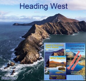
If you’re planning on setting foot on the shores of Connemara or Achill this summer, this set of three detailed maps will be the perfect guide. The Connemara Mountains are…
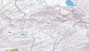
Working away at draft detail for new Kerry maps, still a long way to go but it’s interesting terrain and you wouldn’t notice the days slipping by. Leaving aside the…
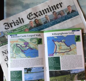
Purchase the Irish Examiner this past weekend and for the next two weeks and you’ll get a walking trail supplement. Entitled 100 Irish Trails, this is published in association with…
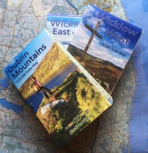
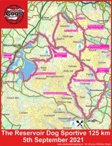
Three New 1:25,000 scale detailed maps are now available for the Dublin Mountains, Wicklow West and Wicklow East. It may have taken five years with lots of hiccups and hard…
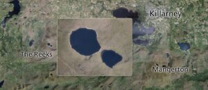
Cleared the decks temporarily and making a start on plotting draft detail for parts of Kerry. In this case, two maps of The Reeks and Mangerton, overlapping around the Gap…
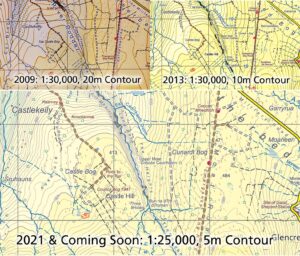
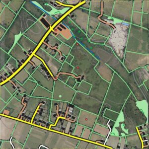
We hope shortly to have a new 1:25,000 map of the Dublin Mountains. It may be of interest to see how this map has developed over the past decade. Here…