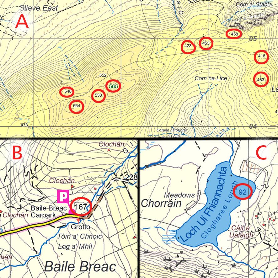
Inserting spot heights is a stage in map production, these are measured from a digital surface model with an accuracy of +/- 0.5 metre on open terrain. Spot heights are useful to the map user for various reasons: firstly to know the height above datum for say a hill top or lake, but secondly to help quickly calculate total height to be climbed or lost. In order to calculate how long it’ll take to walk between two places (apart from walking speed) it’s normal to add a minute for every 10 metres uphill to be climbed. This can be done by counting contours but it’s much handier to simply check spot heights along your intended route and subtract one from other etc.
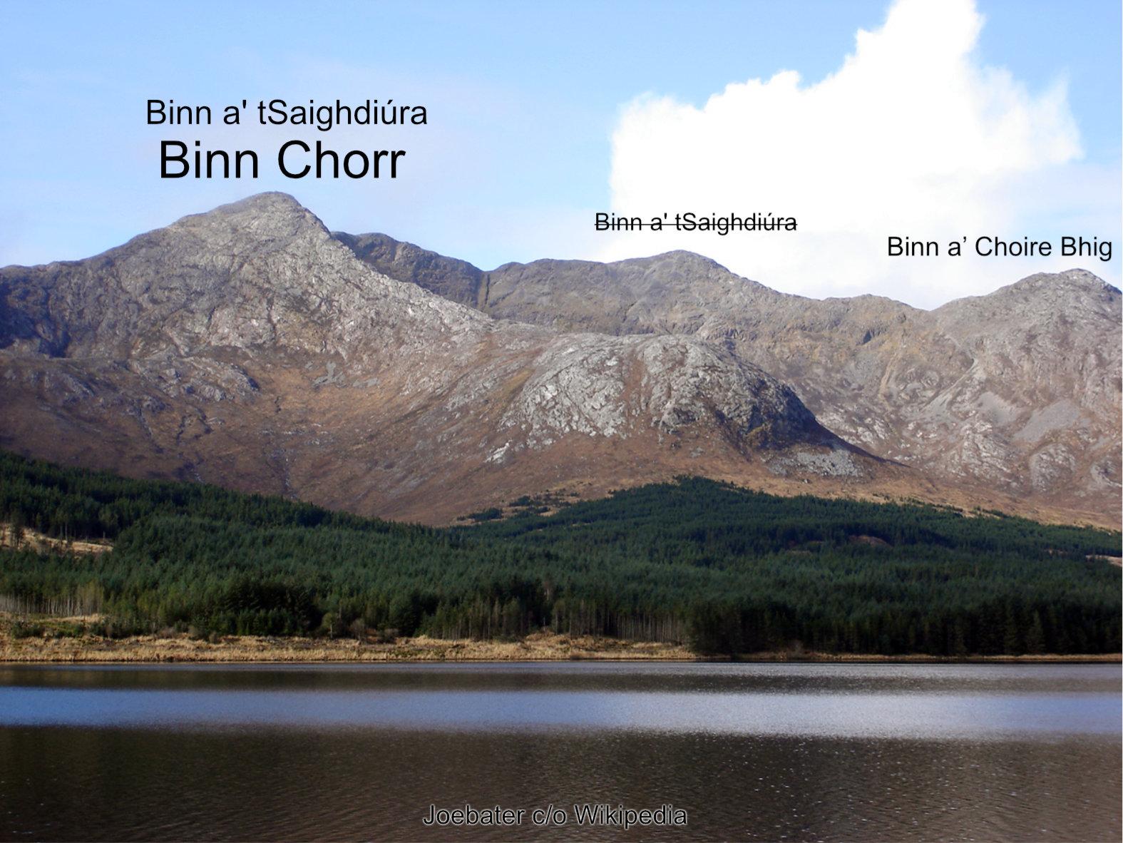
On our maps, we use a black dot for a stone cairn or definite summit outcrop and the adjacent spot height refers to this. Where there is no summit cairn or in a col, the spot height refers to the ground in general at this place. Spot heights for summits are rounded down, so measurements of 601.1m and 601.9m are both rendered as 601m. In other instances like saddles, cols or changes in slope on spurs, we round to nearest metre. A spot height coloured Green indicates an Arderin summit, this definition used by the MountainViews community denotes a hill of 500 metres plus in altitude, with a difference of at least 30 metres in height with adjacent tops. There are currently 408 such Arderins on the island of Ireland.
Choosing where to measure & insert spot heights on the map is a matter of design & judgement, knowing the likely needs of the end user. Here are a few examples where I plot spot heights: a) summits and cols to allow for height computation b) popular car parks & starting points from roads and c) lakes.