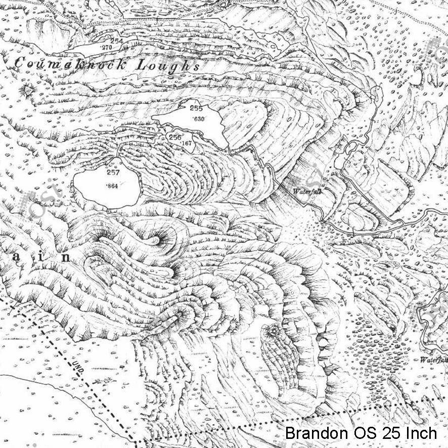
Brandon OS 25 Inch
This extraordinary piece of cartography comes from the Ordnance Survey 25 Inch or 1:2500 scale series compiled in the late 19th & early 20th century. It depicts in exquisite detail the cliffs and moraines found on north & east slopes of Brandon Mountain in Co.Kerry.
In the absence of detailed contours, some fieldworker went to great lengths here to represent the shapes of the cliffs and the huge boulders in the scree & moraine below.
You can view more at https://webapps.geohive.ie/mapviewer/index.html Zoom in on Dingle and Brandon Mountain and then switch the view to MapGenie 25 Inch in the palette of maps.
#eastwestmapping #thedingleway #mountaineering_ireland