Cillín at Lisvernane
Cillín at Lisvernane
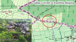
Thanks to Michael Moroney of Lisvernane who advises that the site photographed here is known locally as a cillín. Such sites are often associated with the burial of infants or…

Placenames & Heritage
Thanks to Michael Moroney of Lisvernane who advises that the site photographed here is known locally as a cillín. Such sites are often associated with the burial of infants or…
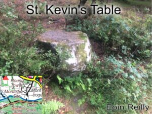
The Schools Collection for Glendalough school of the 1930s describe the various monastic remains around Glendalough. Included is mention of Saint Kevin’s Table which is described as a round, flat…
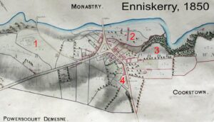
Enniskerry 1850 Here’s an interesting map of Enniskerry, Co.Wicklow dated 1850. The village was part of the extensive Powerscourt Estate which encompassed all of Glencree and extended to Sally Gap.…
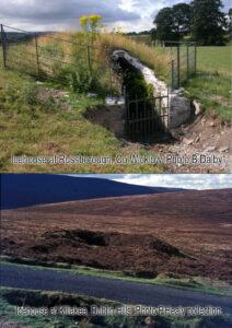
Icehouses are a heritage feature that you may come across marked on maps by EastWest Mapping. They are usually found as ‘cave like’ rooms built into a hillside, not unlike…
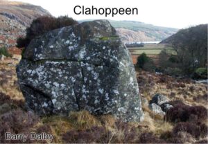
Clahoppeen This is the Clahoppeen rock, it features a few times in the notes left by Liam Price and must have been a notable landmark for local hill farmers in…
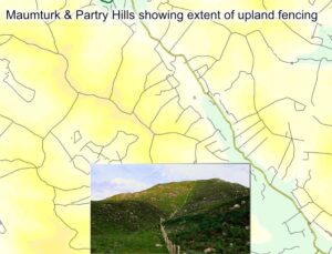
Connemara Upland Fencing Whilst compiling detail for our Connemara Mountains, I was often struck by the dense network of modern upland fencing. Where older walls and fences bend to the…
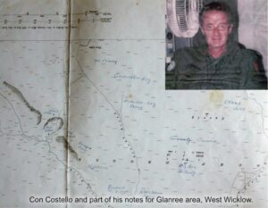
Con Costello 1929-2006 Placenames on EastWest Mapping maps come from multiple sources. The best information is collected directly from those who are ‘seed & breed’ of the district, who’ve grown…
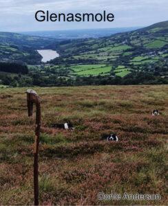
Glenasmole To conclude this mini series on the lovely valley of Glenasmole, let us consider the name and it’s possible meaning. There are two lines of thought: the first is…
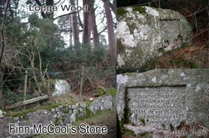
Finn McCool’s Stone The Castlekelly bog road starts at the back of Glenasmole valley and a short way in on the left is a large granite rock called Finn McCool’s…
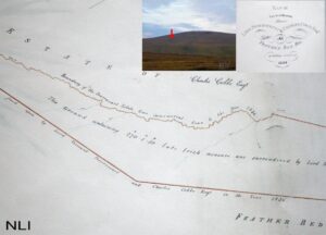
The New Mearing I’m sure a good few readers here have approached Kippure Mountain in the Dublin Hills by means of the long straight Moat Bog Road from the Featherbeds.…