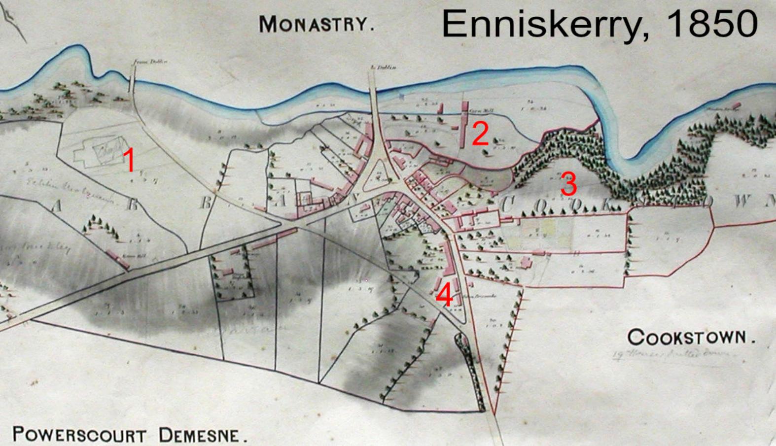
Enniskerry 1850
Here’s an interesting map of Enniskerry, Co.Wicklow dated 1850. The village was part of the extensive Powerscourt Estate which encompassed all of Glencree and extended to Sally Gap. Of interest are the following notes:
1 St.Mary’s chapel is shown sketched in pencil. It was built in 1859, a decade after this map was made on land given over by the estate. Prior to that mass was said locally in Dixon’s barn.
2 Corn mill was powered by a mill race taken off the Cookstown River.
3 The ‘Twenty Bends Road’, the R117 didn’t exist. The route to Bray led along the windy Cookstown Road from Powerscourt Gates.
4 The Police Barracks was at the top of the street.