Mullaghcleevaun 1915, Maulin
Charles Thompson Day 3
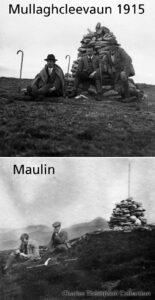
Charles Thompson group on the summit of Mullaghcleevaun on 25th April 1915. It’s sobering to reflect that elsewhere in Europe on that day, Irishmen from the Dublin & Munster Fusiliers…

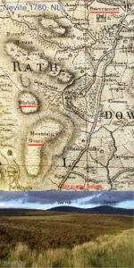
Wicklow East Map
Charles Thompson group on the summit of Mullaghcleevaun on 25th April 1915. It’s sobering to reflect that elsewhere in Europe on that day, Irishmen from the Dublin & Munster Fusiliers…
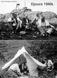
Today’s Charles Thompson image is from Djouce, a very popular and much photographed hill in east Wicklow. The chaps are having a wee dram at the summit tor. Note the…
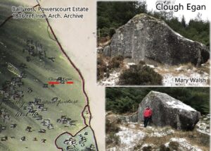
Very pleased to rediscover the location of a large rock in Glencree. Co.Wicklow called Clough Egan / Cloch Egan. This with the help of local resident Mary Walsh who kindly…
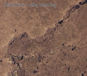
Those who ramble the hills and venture across valleys and rocky slopes will be familiar with hearing the tinkle of running water under their feet, even though no stream is…
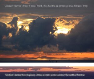
About a week ago, Bernadette Danaher posted photos taken by her brother from the South Stack lighthouse, near Holyhead in Wales. The photos were taken at dusk with the sun…
War Hill is a round boggy summit adjacent to Djouce (usually spelt Douce on older maps). War Hill is an odd but old name, found on the earliest detailed map…
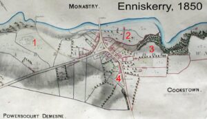
Enniskerry 1850 Here’s an interesting map of Enniskerry, Co.Wicklow dated 1850. The village was part of the extensive Powerscourt Estate which encompassed all of Glencree and extended to Sally Gap.…
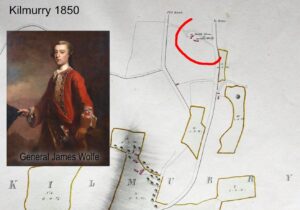
General Wolfe – a mystery? Whilst looking through a series of Powerscourt Estate maps of 1850, I noticed a little historical note on the map of Kilmurry townland near Kilmacanogue…