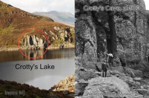
Crotty's Cave
Crotty’s Cave
William Crotty is a nebulous figure in the folklore of Clonmel and Waterford. An 18th century rapparee in the same mould as Freney the Robber, Caher Roe and Cock a…

EastWest Mapping Blog
William Crotty is a nebulous figure in the folklore of Clonmel and Waterford. An 18th century rapparee in the same mould as Freney the Robber, Caher Roe and Cock a…
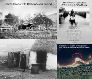
I’m currently recompiling map detail around Poulaphuca Reservoir or Blessington Lakes. This large body of water was created in 1940, following construction of a dam and hydro electric scheme at…
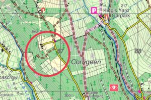
Many thanks to Maureen O'Brien for spotting and sending on details of this new forest road construction in the Galty Castle/ Corrigeen area of our Galtee 1:25,000 map. Probably been…
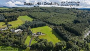
Where is Saggart Hill? I’ve always thought that Saggart Hill lies west of the Brittas in Co.Dublin. Planted with a Coillte forest and known by the name Slieve Thoul, there’s…
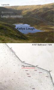
I have reported here previously that the hill overlooking Kellys Lough in Co.Wicklow is locally called the Lough Mountain. This is erroneously labelled as Corrigasleggaun on some maps. This name…
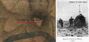
Those who walk the Dublin Hills will be familiar with the name Seahan as published by the Ordnance Survey and it’s burial cairn etc. When I first started looking more…
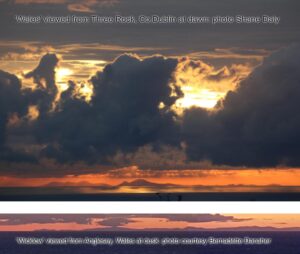
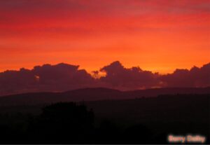
About a week ago, Bernadette Danaher posted photos taken by her brother from the South Stack lighthouse, near Holyhead in Wales. The photos were taken at dusk with the sun…
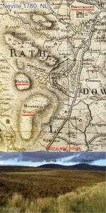
War Hill is a round boggy summit adjacent to Djouce (usually spelt Douce on older maps). War Hill is an odd but old name, found on the earliest detailed map…
I like standard time or natural time. I like the idea that the concepts of noon, midday or midnight have some basis in reality. In standard time, we have roughly…
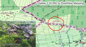
Thanks to Michael Moroney of Lisvernane who advises that the site photographed here is known locally as a cillín. Such sites are often associated with the burial of infants or…