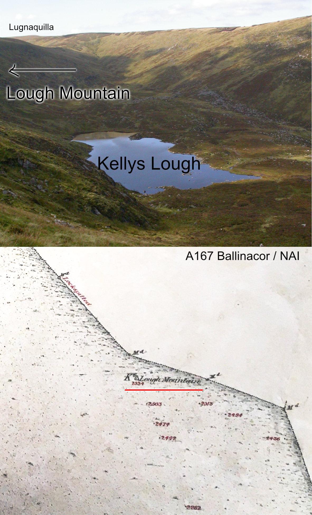
I have reported here previously that the hill overlooking Kellys Lough in Co.Wicklow is locally called the Lough Mountain. This is erroneously labelled as Corrigasleggaun on some maps. This name only appeared on printed maps in the last couple of decades and is likely the result of misunderstanding / misinformation. Corrigasleggaun is in fact a boulder field / patch of rocks on the western slopes of the Lough Mountain.
Whilst I knew that Lough Mountain is the local name for this height, I was interested to come across the attached image in the Ordnance Survey archives. On this draft six inch map dated April 1839, the survey teams labelled this as the ….. Lough Mountain.


