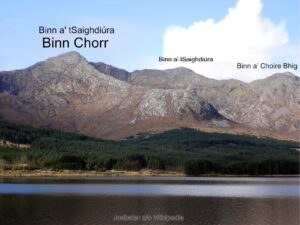
Binn a’ tSaighdiúra
Binn a' tSaighdiúra The astute user of maps of the Twelve Bens will be familiar with the name Binn a' tSaighdiúra and it’s location roughly halfway between Binn Chorr (Bencorr)…

Binn a' tSaighdiúra The astute user of maps of the Twelve Bens will be familiar with the name Binn a' tSaighdiúra and it’s location roughly halfway between Binn Chorr (Bencorr)…
Some users of our EastWest Maps phone app for Android devices may find it has stopped working on their device. If so, please go to the Google PlayStore and download…
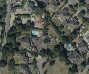
Costa del Dublin I’m currently working my way through South County Dublin, recompiling our mapping to our 25Series standard. Started in the west over near Rathcoole and now approaching Dun…
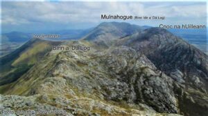
Mulnahogue Thanks to everyone who has purchased our newly released Connemara Mountains map. It’s been well received to date and please continue to spread the word. https://eastwestmapping.ie/product/connemara-mountains/ I’ll deal with…
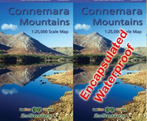
Connemara Mountains Map I’m happy to advise that our new Connemara Mountains 1:25,000 is now available. Covid19 has delayed publication by over two months but better late than never! Definitive…
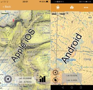
EastWest Maps App Updates This to advise customers that updated versions of our EastWest Maps phone app running on both Android and Apple iOS mobile devices will shortly be available.…
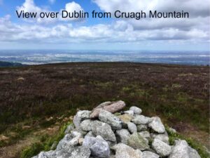
The Curious Case of Cruagh I grew up in Dublin and with friends I often cycled or got the No.47 bus up towards Rockbrook, and then on up to a…
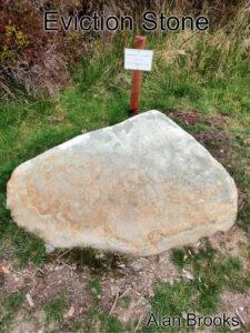
Raheenleagh Map Update Thanks to map user Alan Brooks who sent in a photo and note regarding a memorial stone that has been uncovered and now marked at Raheenleagh forest…
Irish Measurements If I have to make survey measurements and/or do calculations, I’d always use the metric system: metres, hectares, cubic metres, kilos and litres etc. Just so much easier.…
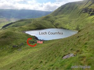
Thanks to customer and map user John Hughes for passing on details of a small hut site or sheep pen that was missing from our Comeragh 1:25,000 map. Here's John's…