Raheenleagh Update
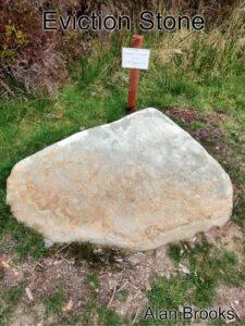
Raheenleagh Map Update Thanks to map user Alan Brooks who sent in a photo and note regarding a memorial stone that has been uncovered and now marked at Raheenleagh forest…

Raheenleagh Map Update Thanks to map user Alan Brooks who sent in a photo and note regarding a memorial stone that has been uncovered and now marked at Raheenleagh forest…
Irish Measurements If I have to make survey measurements and/or do calculations, I’d always use the metric system: metres, hectares, cubic metres, kilos and litres etc. Just so much easier.…
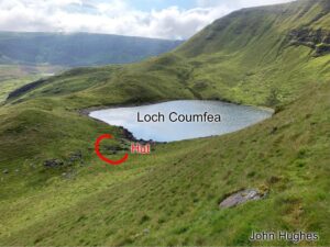
Thanks to customer and map user John Hughes for passing on details of a small hut site or sheep pen that was missing from our Comeragh 1:25,000 map. Here's John's…
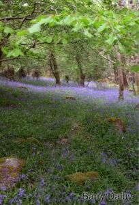
The bluebells have really thrived this year, we are fortunate to live near woodland carpeted with a bluish haze. But the banks of the ditches and even the garden are…
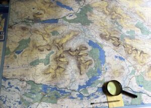
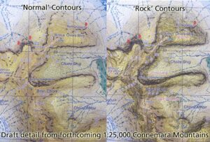
Connemara Mountains Proof Just examining a printers proof of our new Connemara Mountains map whose production has been interrupted by Covid19 etc. Notwithstanding that self-praise is no praise, I can…
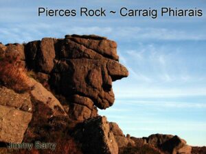
Jimmy Barry in his book Under Galtee Skies has a photo of a strange head shaped rock of which he writes that it lies above Ballydavid Wood near Cahir. I…
Many people who drive along the Military Road across the Featherbed Bog in the Dublin Mountains would be unaware of this simple but remarkable stone. It's only a couple of…
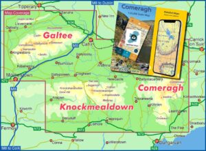
The digital version of the Comeragh Galtee map is now available for the EastWest Maps app running on Android and iOS devices. The EastWest Maps app with test map of…
I've been making fairly steady progress on a new 1:25,000 scale map Connemara Mountains. Was planned to go to print by around month end but some fieldwork required and there…
If you use Facebook and would like a couple of news items a week relating to our mapping work - observations on placenames and all that sort of thing, then…