New Dingle Maps
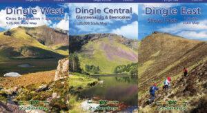
New Dingle Maps Three new detailed 1:25,000 scale maps for the Dingle peninsula are now available. Please share this news to anyone who you think will be interested and find…

New Dingle Maps Three new detailed 1:25,000 scale maps for the Dingle peninsula are now available. Please share this news to anyone who you think will be interested and find…
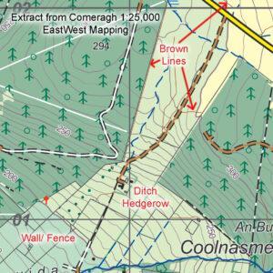
Brown Lines What are the ‘brown lines’ on maps by EastWest Mapping? We use three line symbols for boundaries/ linear features on our maps ~ in green, black & brown.…
We are all encouraged to walk & cycle more now as a means of local transport. Cycle lanes and Greenways are built at some cost to encourage sustainable local transport.…
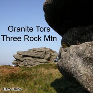
Granite Tors The Dublin Hills may be modest in height and terrain but they sport a few dramatic outcrops of rock. Granite tors as in the photo here can be…
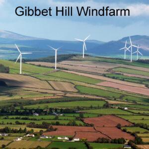
Some people love them, some people hate them. Some think they are elegant, others that they’re a blight on the landscape. Some think they are necessary, others that alternative technologies…
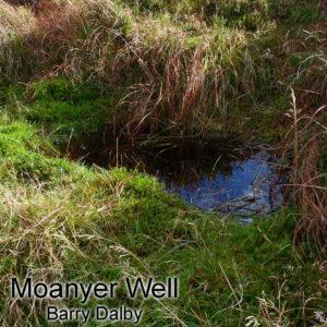
Moanyer Well Nestled in a clump of sedges and sphagnum, this little pool called Moanyer Well is deserving of it’s own name high up on the shoulder of Mount Leinster.…
This is an example of one of numerous map illustrations made and supplied by EastWest Mapping over the years. For brochures, public information board signage and in this case used…
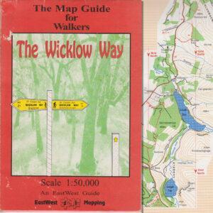
Wicklow Way 1993 Pictured here is the first EastWest Mapping publication from 1993, thirty years ago. There was no accurate map of the full Wicklow Way walking route then and…
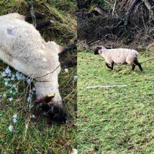
If you wander the hills, farmland or forest at all, you must eventually come across farm animals that are in a spot of bother. You could walk past thinking someone…
The now annual Art O’Neill Challenge takes place this January 13th. A challenge event journeying overnight from Dublin Castle to Glenmalure and commemorating the escape & flight of Art &…