
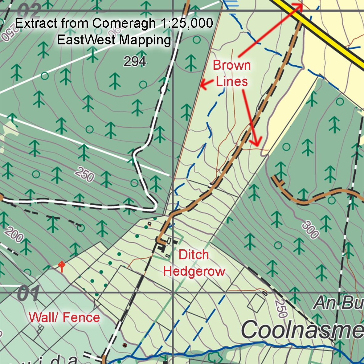
Brown Lines
What are the ‘brown lines’ on maps by EastWest Mapping? We use three line symbols for boundaries/ linear features on our maps ~ in green, black & brown. See the attached extract from our popular Comeragh map at 1:25,000 scale.
Green lines represent hedgerows or ditches as rural people would call them. These can be anything from mature lines of standing trees, to cropped hedges and also field boundaries of furze, gorse or whin according to your preference.
Black lines represent walls and fences that should be clear on the ground.
Brown lines represent anything else of this nature! Usually linear and usually manmade. Examples might be broken down fences, old earth banks, machine cuttings on a hillside for drainage. They can also represent gullies, a linear trench – sometimes these might be natural erosion gullies but more likely they’ll be old bog tracks zigzagging up a hill. Turf was often cut high up and brought down via a slipe, a narrow v shaped wheelless contraption of spars loaded with turf and pulled/ dragged/ sliped down by donkey or mule. All that’s left now is an old bank or trench, no path as such.
So essentially the brown line represents any similar linear feature that’s not a clear ditch/ hedgerow or wall/ fence.
#eastwestmapping #madetomove #wicklowmountains #munstervales
Great to have this clarity. Out on Brockagh recently, and these lines really help in understanding the terrain.