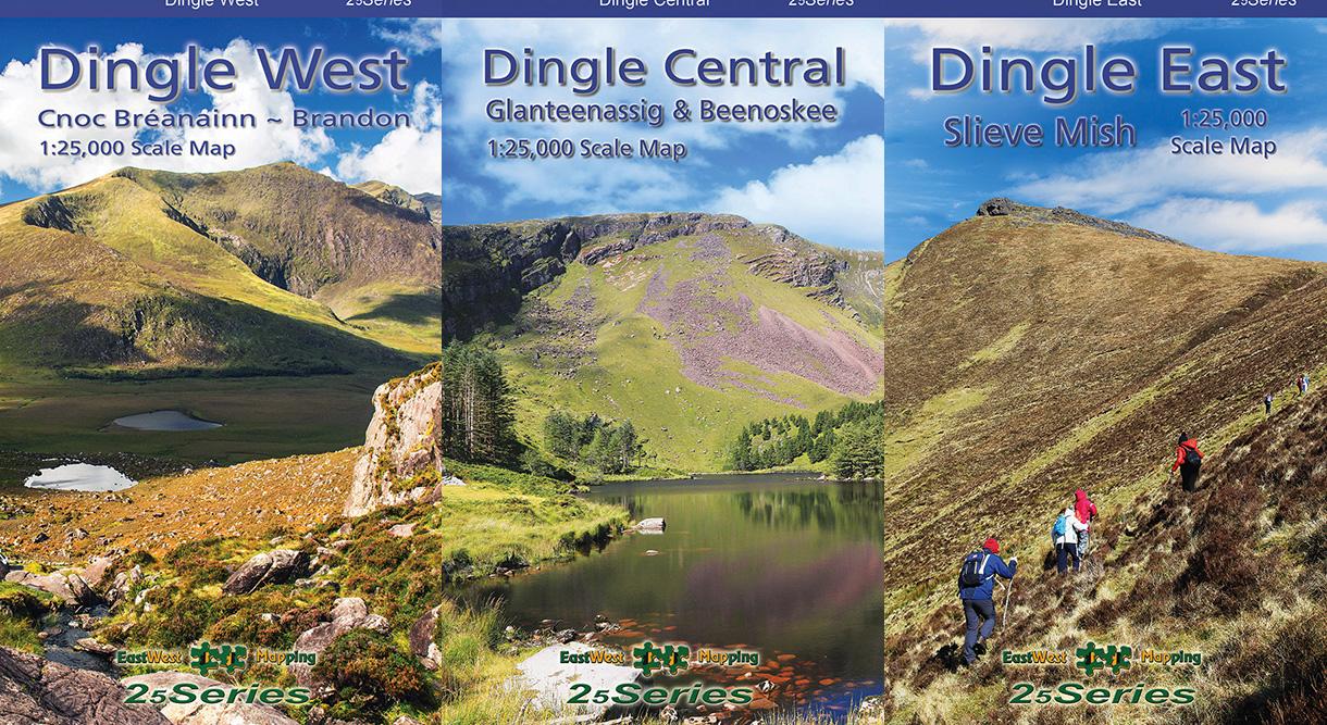
New Dingle Maps
Three new detailed 1:25,000 scale maps for the Dingle peninsula are now available. Please share this news to anyone who you think will be interested and find these maps of good use.
Dingle West map covers from Dunquin to Mount Brandon to the Conor Pass including Dingle town. Purchase Dingle West.
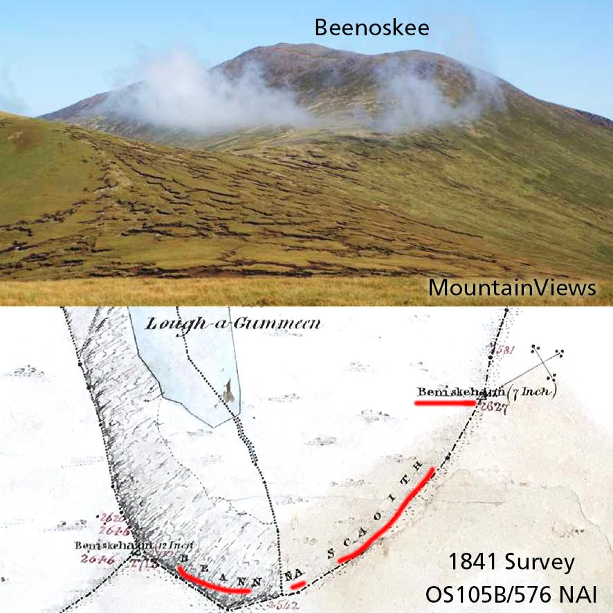
Dingle Central map covers the Conor Pass to Camp including Glanteenassig & Beenoskee. Purchase Dingle Central.
Dingle East map covers the Slieve Mish hills including Tralee and extending to Killorglin. Purchase Dingle East.
These maps are produced to our 25Series standard with a 5 metre contour interval and fine detail. Many local placenames labelled variously in anglicised and Irish forms. There is a good overlap between sheets, partly of necessity due to the shape of the region but which also conveniently divides the area into three blocks.
These maps can be purchased in either standard paper folded or laminated waterproof folded versions. They are available singly or as a set of Three Dingle maps and also as part of a set of Five Kerry maps. Finally we have a limited number of flat unfolded versions suitable for wall display etc – these are available as a set of three for Dingle and not separately.
There will be a digital version for phone app Hiiker in due course. This will cover a wider area, including the Blasket and Tearaght islands in the west and northwards to Banna Strand. Southwards it will overlap with our Reeks and Killarney mapping. I’m not sure when this will be finished but hope to have it by June in time for the Tom Crean walk. In the meantime, please buy the print maps and support the considerable work & costs involved in developing this mapping. Thank you.
#eastwestmapping #thedingleway #visitkerry #reeksdistrict