Dublin Wicklow Map News
Dublin Wicklow Map News
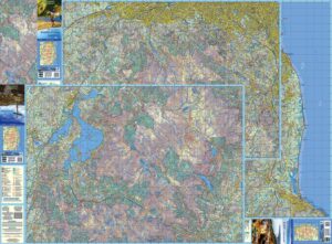
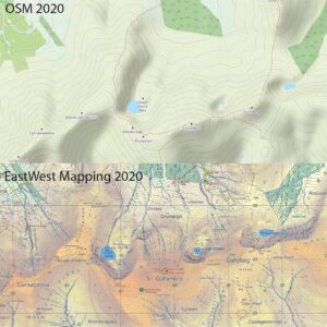
Our three new 1:25000 scale maps for the northern Dublin & Wicklow mountains have gone to proofing stage with the printer. These are prepared to our 25Series standard with 5…

Our three new 1:25000 scale maps for the northern Dublin & Wicklow mountains have gone to proofing stage with the printer. These are prepared to our 25Series standard with 5…
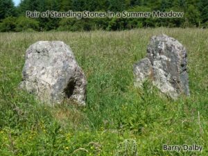
This photo was taken in the mighty summer of 2018: a pair of standing stones set in a rich summer meadow. I like it firstly because it’s the small details…
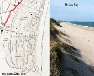
We often read these days of coastal erosion, of winter storms battering away, removing beaches and soft cliffs. But as well as taking away, the sea also giveth. That material…
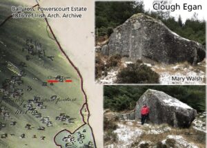
Very pleased to rediscover the location of a large rock in Glencree. Co.Wicklow called Clough Egan / Cloch Egan. This with the help of local resident Mary Walsh who kindly…
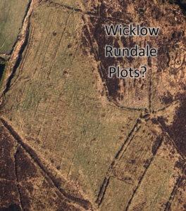
Rundale was a system of land management between farmers that seems to have common enough in the west of Ireland in early/ mid 19th century. It predated the enclosure of…
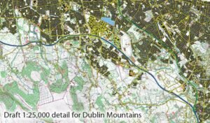
This is to advise that steady progress is being made on three new map sheets covering the North Wicklow region. These are being prepared to our 25Series standard with a…
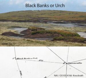
I’ve written previously about the name ‘Table Mountain’ in the Wicklow hills and reported that locally this area is still known as the Black Banks. That the name Table Mountain…
The Galtee Mountains have plainly been a busy place this past year, notwithstanding travel restrictions and lockdowns. This is evident from the Ireland Walking Awards run by Kieron Gribbon in…
Anyone around in the late 1970s will recall the hit song ‘Video Killed the Radio Star’ by the Buggles. Video hasn’t quite killed radio yet, but I’ve no doubt that…
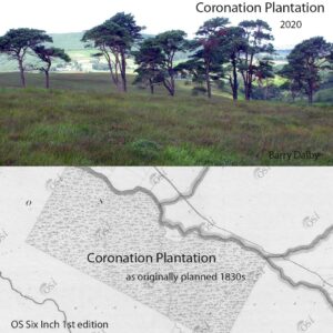
The scattered Scots Pine and Oak trees of Coronation Plantation near Sally Gap in Wicklow are the subject of many a photograph. Planted in 1831 by the Downshire Estate, the…