
Visiting Glendalough
If you’re visiting Glendalough this summer and looking to pick up one of our detailed maps for your outing, then you might like to check out the new Adventure.ie store…

If you’re visiting Glendalough this summer and looking to pick up one of our detailed maps for your outing, then you might like to check out the new Adventure.ie store…
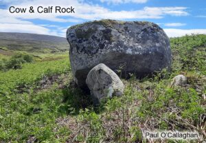
Thanks to map user Paul O’Callaghan for sending on this photo of the Cow & Calf Rock located in Upper Glenasmole in the Dublin Mountains. This large granite boulder is…
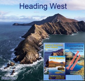
If you’re planning on setting foot on the shores of Connemara or Achill this summer, this set of three detailed maps will be the perfect guide. The Connemara Mountains are…
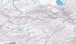
Working away at draft detail for new Kerry maps, still a long way to go but it’s interesting terrain and you wouldn’t notice the days slipping by. Leaving aside the…
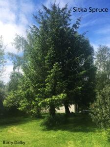
Sitka Spruce as a tree species gets a bad rap in Ireland. Making up c 45% of commercial plantations and grown sometimes as near monocultures – various labels are put…
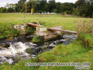
This photo taken 2008 is of a footbridge across the Kilbride or Brittas River at Manor Kilbride in Co.Wicklow. It’s part of an old school / mass / general shortcut…
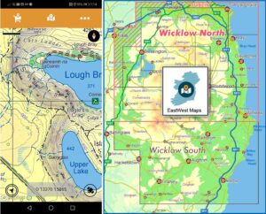
This to advise users of our mobile app EastWest Maps of two updates: 1) The Android version of EastWest Maps app now displays location in Irish Grid co-ordinates. The current…
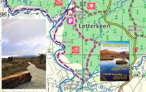
Thanks to Michael Chambers of Ballycroy National Park & Shramore for advising of a new signposted walking route that has recently been laid out at the popular Letterkeen trailhead near…
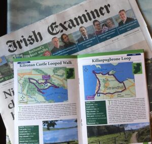
Purchase the Irish Examiner this past weekend and for the next two weeks and you’ll get a walking trail supplement. Entitled 100 Irish Trails, this is published in association with…
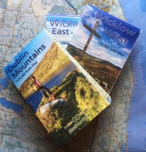
Three New 1:25,000 scale detailed maps are now available for the Dublin Mountains, Wicklow West and Wicklow East. It may have taken five years with lots of hiccups and hard…