Burke’s Cave
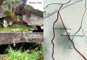
Burke's Cave One of the interesting aspects of examining old maps is that they often show long gone features from the past, particularly in urban areas. However due to the…

Placenames & Heritage
Burke's Cave One of the interesting aspects of examining old maps is that they often show long gone features from the past, particularly in urban areas. However due to the…
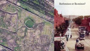
Raths and Raws The rath or ringfort is a ubiquitous feature in the Irish landscape - there are thought to be 40,000 plus sites. These circular enclosures were used as…
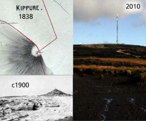
Kippure - The Pole Kippure is a townland and also the name given to the highest mountain in Co.Dublin at 757 metres in altitude. Straddling the Dublin/Wicklow border, it is…
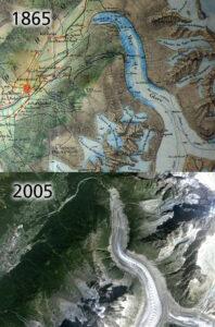
Mer de Glace & global warming Global warming is in the news a lot these days and one of the oft quoted pieces of 'evidence' is the retreat of the…
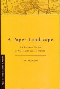
'A Paper Landscape - the Ordnance Survey in Nineteenth Century Ireland' by J.H. Andrews first published 1975, second edition 2001. This is the only detailed history of the Ordnance Survey…
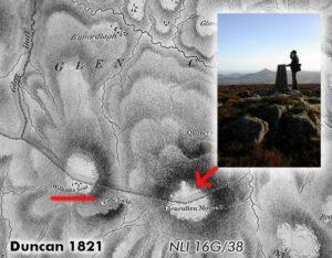
The curious case of Prince William's Seat or Clusnaspeire Prince William's Seat is the Ordnance Survey name for the hill of 555 metres in height on the Dublin & Wicklow…
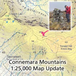
Connemara Mountains Map Update Thanks to Patsy Cahalan and Proinsias de Paor for supplying details of two notable cairns that lie between Cruach Láir and Tonald Hill on our Connemara…
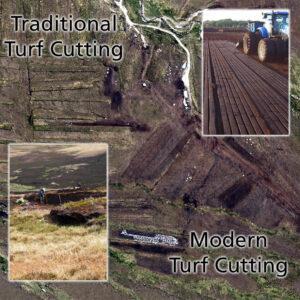
Turf Cutting Old & New Getting to that time of year when traditionally turf will be cut as the bogs dry out a bit in early summer. The sods are…
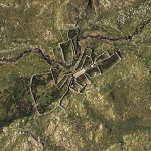
Sheep Pen Complex Spotted what looks like an extraordinary complex of sheep pens when plotting detail. Notice how the entrances to the paddocks seem to radiate from a central area.…
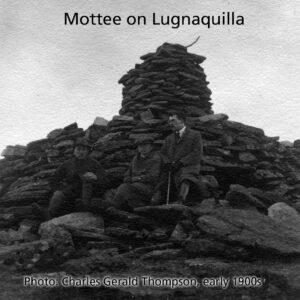
Pointy Manmade Things There are several & various terms used for pointy things in the Irish upland landscape. These are usually man made objects that stick out on the skyline.…