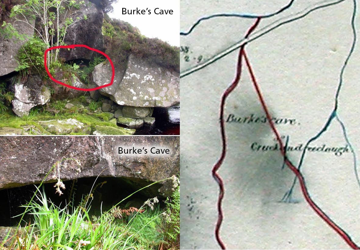
Burke’s Cave
One of the interesting aspects of examining old maps is that they often show long gone features from the past, particularly in urban areas. However due to the slower pace of change in upland regions, there is a good chance that similar features can still be located. Such is the case of Burke’s Cave on the banks of the Quarry Brook, a little west of Sally Gap in Wicklow.
I spotted this on a Powerscourt Estate map dated 1850. I was interested in the name Cruckandreeclough near it, ‘the small hill of the three rocks’ and figured the physical evidence for the name still likely remained. As for the cave, experience told me that sometimes these existed but in other locations they have fallen in or been covered up etc. After referencing the map to my modern survey, I loaded a copy onto the GPS and set off to look about.
Sure enough, I soon spotted a little hillock swelling from the bog as I wandered uphill towards the location and there on the crest lay a cluster of small boulders – just about distinctive enough to fit the description. I then crossed the hillside to the Quarry Brook, aiming to hit it a bit above the marked location of the cave. As I followed the brook down, there was a dark hole on the far bank, see photos, which turned out to be a good sized horizontal cave. Maybe about a metre high but 2-3 metres in width and extending back about the same amount. It would hold two people easily enough, not in great comfort though.
The question though is – who was Burke? Is it a 1798 cave, a site assoc with rebels hiding? Or perhaps it has connections to what were once iron workings nearby at Shranamuck?