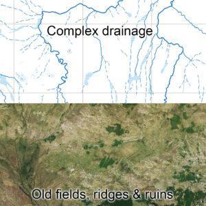
Mweelrea Plot
Mweelrea Plot For the past several months I’ve been tipping away at the detail plot for new 1:25000 mapping for the region between Killary Harbour & Clew Bay. So essentially…

EastWest Mapping Blog
Mweelrea Plot For the past several months I’ve been tipping away at the detail plot for new 1:25000 mapping for the region between Killary Harbour & Clew Bay. So essentially…
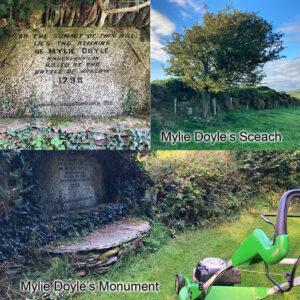
Mowing the MonumentAround this time 25 years ago, the towns & villages of Wexford, Wicklow & Carlow reverberated to the marching of local groups of pikemen & women. Formed to…
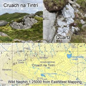
Cruach na TintríCruach na Tintrí is the name of a lumpy hill just north of Mulranny in Co.Mayo, you’ll find it on our Wild Nephin 1:25K map. It’s called Claggan…
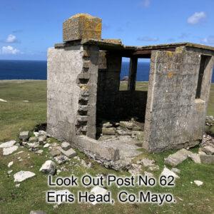
WW2 Look Out Posts The Republic of Ireland was not directly involved in World War 2 from 1939-45, a period called The Emergency here. It was broadly supportive of the…
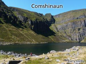
Coms Coums Corries & Kyas Those who walk the Irish uplands will be familiar with bowl like lakes nestling into the slopes under the peaks. Often backed by cliffs, the…
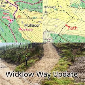
Wicklow Way Update Map update for Wicklow 1:25,000 print maps & Wicklow Way Map Guides. Thanks to Aaron Byrne of Wicklow Partnership for supplying details of a recent re route…
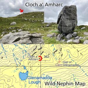
Cloch a’ AmhaircMap update for our Wild Nephin 1:25,000 print map.When I was surveying our Wild Nephin map in 2015, local hill farmer Patrick Moran of Dooghill kindly helped with…
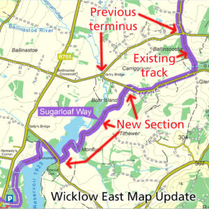
Sugarloaf Way Update Map update for our Wicklow East 1:25,000 print map. The Wicklow Way is a popular signposted walking trail and there have been moves afoot for many years…
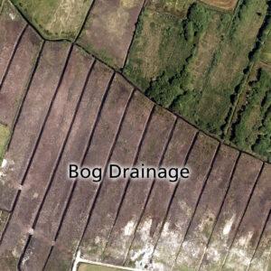
Bog Drainage There’s been a lot of talk recently regarding the re wetting of lands, for various reasons including the absorbing of winter rains and to assist wildlife habitats etc.…
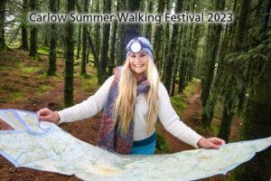
Carlow Summer Walking Festival The Carlow Summer Walking Festival is happening soon – on the 7th to 9th July coming. There will be a selection of guided walks from low…