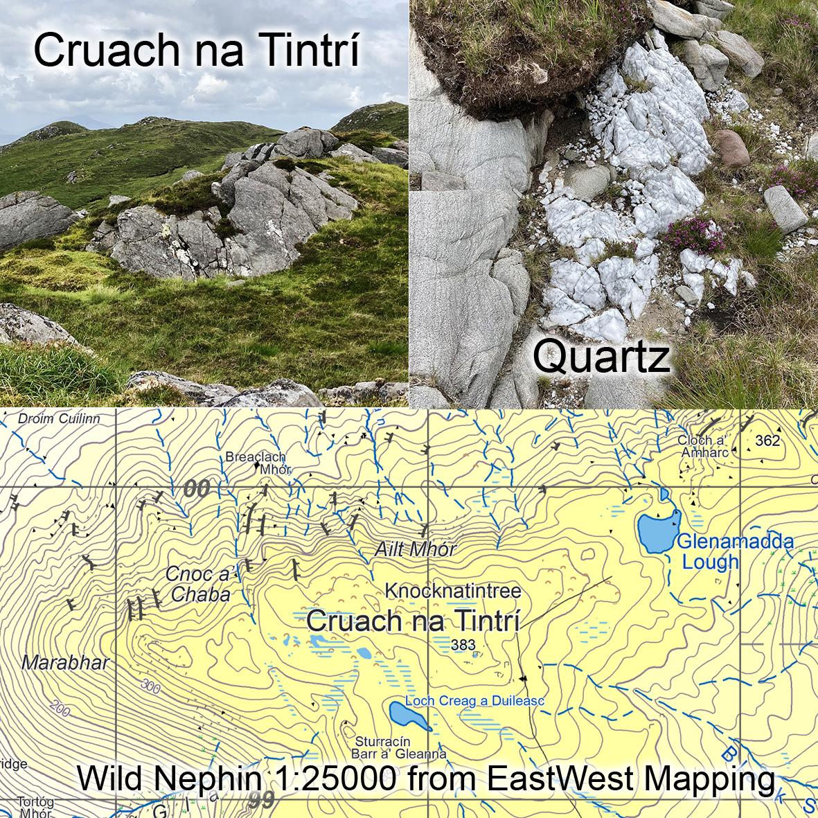
Cruach na Tintrí
Cruach na Tintrí is the name of a lumpy hill just north of Mulranny in Co.Mayo, you’ll find it on our Wild Nephin 1:25K map. It’s called Claggan Mountain on some other sources but Claggan Mountain is a townland name and applies to the mountain grazing attached to the residents of the townland of Claggan. This hill is named as Knocknatintree on William Bald’s map that predates the Ordnance Survey and still locally known as Cruach na Tintrí.
The word cruach is usually applied to a pointy hill as in Cruach Phádraig or Croagh Patrick aka simply The Reek. Cruach na Tintrí though is a lumpy hill with several scattered summits, the most prominent of these is the western hillock seen on the left in the photo here, though note that the higher tops lie to the east.
It’s the word tintrí though that is most curious and unusual in a hill name. Even though the name never appeared on the 19thC Ordnance Survey map, it is listed in the OS name books and remarked that it’s connected to fire or lightning. There is a large rock on the slopes above Mulranny called Cloch Scoilte or Split Rock and I had thought that maybe this was supposed to be split by a thunderbolt etc. However I noticed on a recent visit to Cruach na Tintrí that the summit area has a notable vein of white quartz rock that pokes out here & there as shown in photo. Quartz has always been considered a notable mineral/ rock and since the word tintrí can mean ‘fiery or flashing’, perhaps the name is for this striking bright white mineral found here on this height. Alternatively, perhaps the hill was used for signal fires in the past.
#eastwestmapping #wildnephin_official #wildnephin #visitmayo #hillwalkingireland #outdoorsireland #irishmountains