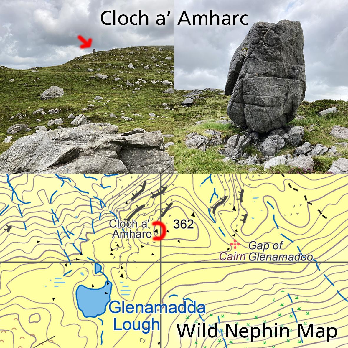
Cloch a’ Amhairc
Map update for our Wild Nephin 1:25,000 print map.
When I was surveying our Wild Nephin map in 2015, local hill farmer Patrick Moran of Dooghill kindly helped with information on the hills above Mulranny and Duhill Bay. One of the names he described was Cloch a’ Amhairc, which he said on the hill or the hill immediately NE of Glenamadda Loch. I placed the name on the map but hadn’t the opportunity to check on the ground till recently.
Cloch a’ Amhairc means the ‘view rock’ or in this case I think, the rock that is easily seen. As I approached on rough trackless ground, the rock was very obvious from a distance and as seen in the photo here. A large egg shaped boulder balanced on the edge of the hill, maybe 3 metres tall.
It lies about 80 metres NW of where I marked it from aerial photos, but the real location is very obvious when seen on the ground. The map extract here shows the updated position and of course, adjustments/ updates like this are part & parcel of map work.
#eastwestmapping #wildnephin_official #wildnephin #visitmayo #hillwalkingireland #outdoorsireland