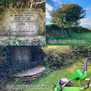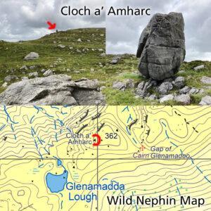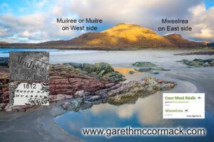
Mweelrea from Glassillaun Beach, Connemara, Co Galway, Ireland.
Mweelrea & Muilree
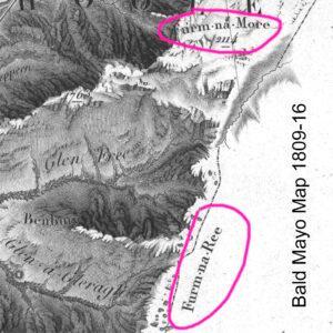
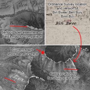
Mweelrea & Muilree I was discussing placenames with several local hill farmers last week in the Mweelrea area and was interested to hear their pronunciation of the name of this…