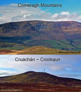
Comeragh Placenames Part 1
Comeragh Placenames Part 1 The name Comeragh or Cummeragh seems to be associated with these hills and region for at least a couple of centuries and more. Charles Smith writing…

Comeragh Map
Comeragh Placenames Part 1 The name Comeragh or Cummeragh seems to be associated with these hills and region for at least a couple of centuries and more. Charles Smith writing…
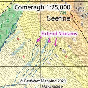
Comeragh Map Update Thanks to map user John Hughes, who reports on the various streams on the SW flank of Seefine in the Comeraghs. That these run higher on the…
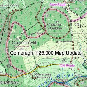
Please note this correction to the route of the East Munster Way walking route at Cannon Hill near Clonmel. You’ll find the detail on our Comeragh 1:25,000 scale map. If…
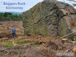
Details of this huge lump of conglomerate rock came to my notice recently and thanks to local man Sean Murphy for photo and information on it. If you park at…
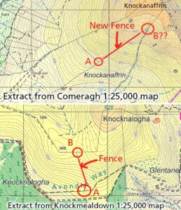
Eagle eyed map user John Hughes has reported two missing features on our Comeragh & Knockmealdown maps respectively. These are upland fences. If anyone reading this is planning a hillwalk…
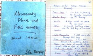
Users of EastWest Mapping maps often ask where we find the local placenames shown on same. The answer is never straightforward as there can be multiple sources with different versions…
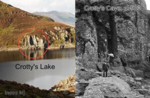
William Crotty is a nebulous figure in the folklore of Clonmel and Waterford. An 18th century rapparee in the same mould as Freney the Robber, Caher Roe and Cock a…
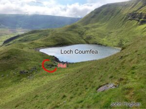
Thanks to customer and map user John Hughes for passing on details of a small hut site or sheep pen that was missing from our Comeragh 1:25,000 map. Here's John's…