Comeragh Map Update
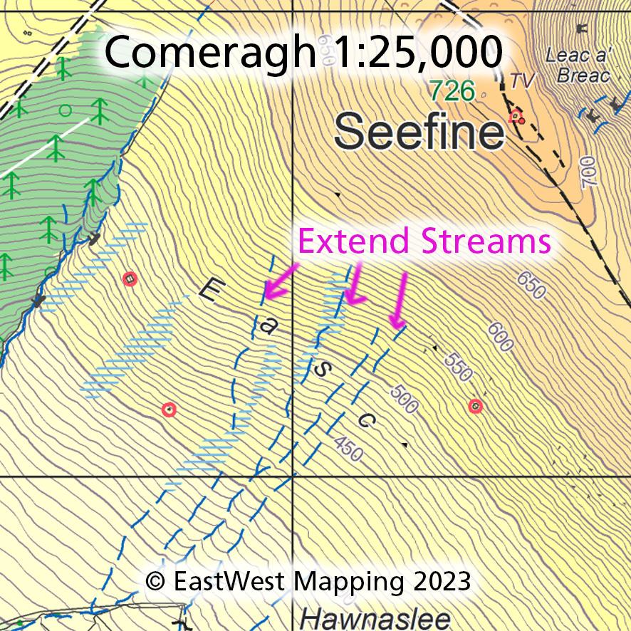
Thanks to map user John Hughes, who reports on the various streams on the SW flank of Seefine in the Comeraghs. That these run higher on the hill than shown on our printed Comeragh map and likewise digital versions. This hill slope is locally known as Easc – Irish word for wet or boggy ground. So in other words, best avoided!
John also spotted that a contour label at the top of the Mahon Falls on the same map should read 600 metres, not 500 as printed.
#eastwestmapping #comeragh #comeraghs #visitwaterford