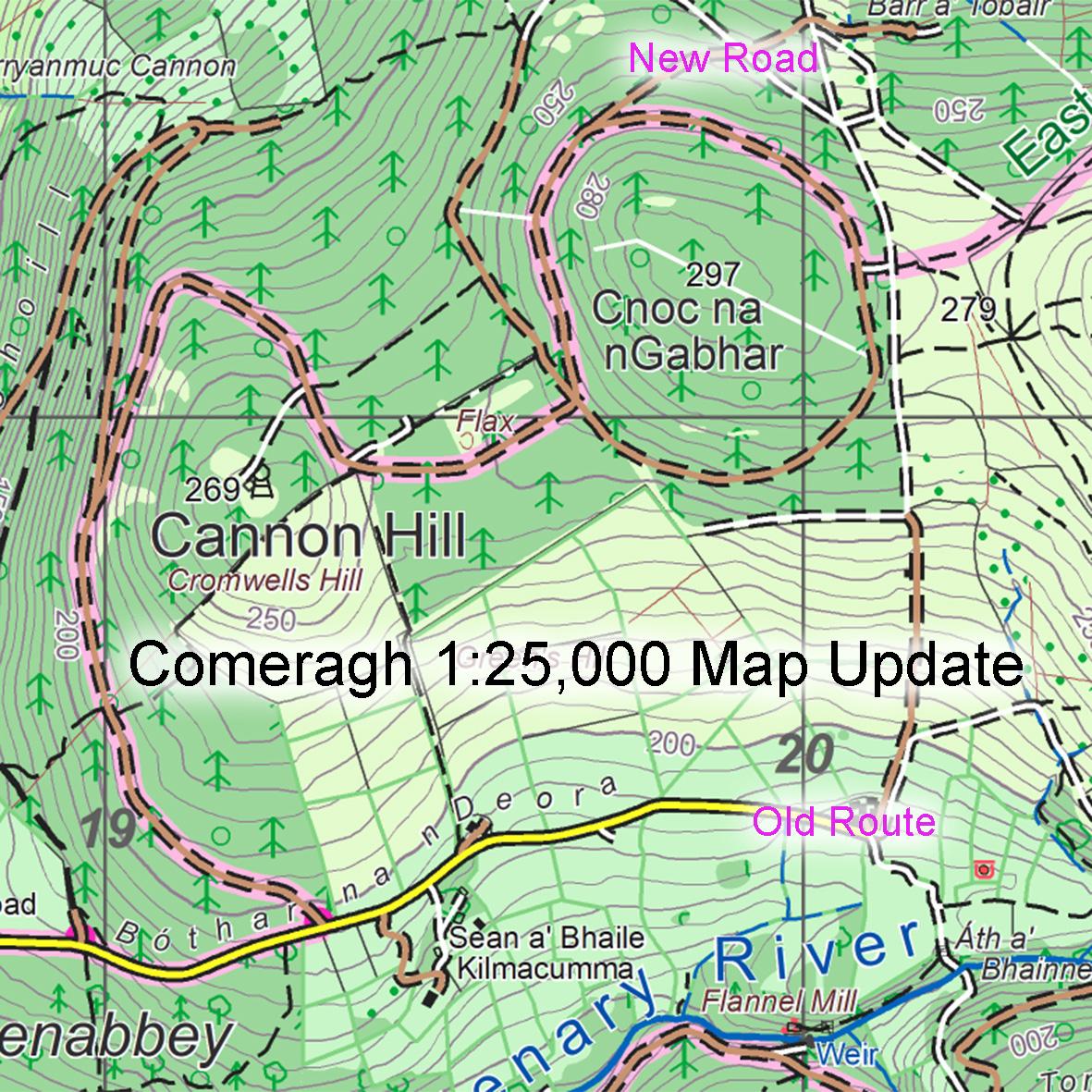
Please note this correction to the route of the East Munster Way walking route at Cannon Hill near Clonmel. You’ll find the detail on our Comeragh 1:25,000 scale map.
If you compare this extract to the print map, you’ll see that the highlighted route of the East Munster Way now runs through the forest around Cnoc na nGabhar and Cannon Hill. If you are hillwalking generally in the area, you are advised to use this in preference to the old route.
There is also a small new forest road constructed as marked near the top of this map extract, so you could mark that in as well on your map.
#eastwestmapping #munstervales