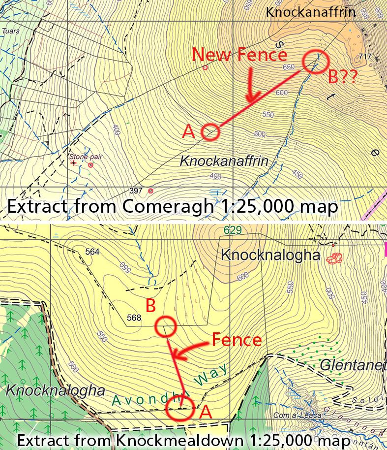
Eagle eyed map user John Hughes has reported two missing features on our Comeragh & Knockmealdown maps respectively. These are upland fences. If anyone reading this is planning a hillwalk in either of the areas below and will be passing nearby these, I’d greatly appreciate if you can have a look and check the detail.
1) Knockanaffrin area of the Comeraghs. There is a new post & wire fence starting from the existing mapped fence corner labelled A and running uphill. To be checked is if this new fence runs all the way to meet point B. So if you were walking the Knockanaffrin ridge, you could pop down and have a look.
2) Gap/ Bay Lough area of the Knockmealdowns. West of The Gap and below Knocknalogha/ Knocknalonga is an older fence that runs uphill from the forest at point A. We think it reaches the ridge above at about point B. This fence is clear enough lower down but maybe broken down higher up. If passing by along this height, appreciate if you can have a look at the fence provisionally marked A-B.
If you use our map app EastWest Maps, the handiest way to record what you see is to stand at the junction/ turns on the fence, take a screen shot and email to us. Or use any app with GPS on your phone and record the Lat/Long or co-ordinates.
Updates will appear on our annual update to digital maps and in due course on map reprints. Thanks and will add a comment below as soon as this is done, so as not to waste anyone’s time.


