Leo O’Connor
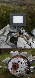
Leo O'Connor Aircrash The Dublin & Wicklow uplands sometimes cause problems for aircraft in poor weather. I can think of seven aircrash sites off top of my head but only…

Placenames & Heritage Notes
Leo O'Connor Aircrash The Dublin & Wicklow uplands sometimes cause problems for aircraft in poor weather. I can think of seven aircrash sites off top of my head but only…
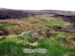
Uisce a’ Fhéir Uisce a’ Fhéir is the name of a stream on the south side of Kippure, draining to the Liffey. So reported Eugene Curry for the Ordnance Survey…
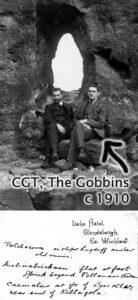
Charles Thompson (CGT) - science teacher, mountaineer and collector of place names A good number of placenames in Wicklow have been added to our maps in the past year. Some…
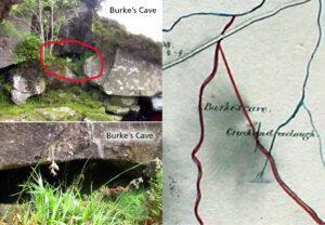
Burke's Cave One of the interesting aspects of examining old maps is that they often show long gone features from the past, particularly in urban areas. However due to the…
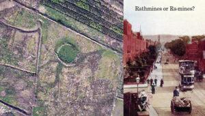
Raths and Raws The rath or ringfort is a ubiquitous feature in the Irish landscape - there are thought to be 40,000 plus sites. These circular enclosures were used as…
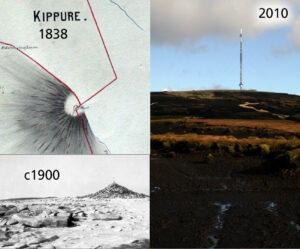
Kippure - The Pole Kippure is a townland and also the name given to the highest mountain in Co.Dublin at 757 metres in altitude. Straddling the Dublin/Wicklow border, it is…
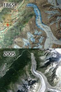
Mer de Glace & global warming Global warming is in the news a lot these days and one of the oft quoted pieces of 'evidence' is the retreat of the…
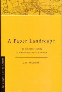
'A Paper Landscape - the Ordnance Survey in Nineteenth Century Ireland' by J.H. Andrews first published 1975, second edition 2001. This is the only detailed history of the Ordnance Survey…
The curious case of Prince William's Seat or Clusnaspeire Prince William's Seat is the Ordnance Survey name for the hill of 555 metres in height on the Dublin & Wicklow…
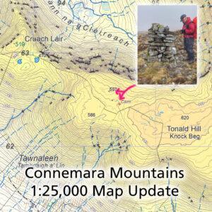
Connemara Mountains Map Update Thanks to Patsy Cahalan and Proinsias de Paor for supplying details of two notable cairns that lie between Cruach Láir and Tonald Hill on our Connemara…