Gala Rock
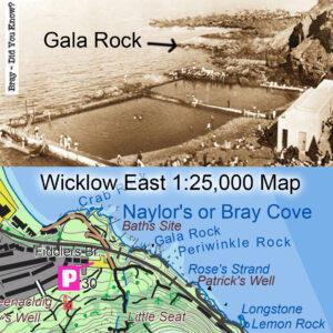
Gala RockThe local placename Gala Rock came to my attention a couple of years ago, but with no exact location, just that it was near Bray. Local man Maurice O’B…

Placenames & Heritage Notes
Gala RockThe local placename Gala Rock came to my attention a couple of years ago, but with no exact location, just that it was near Bray. Local man Maurice O’B…
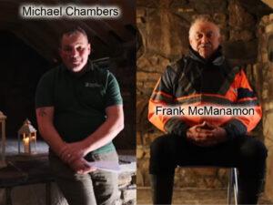
Local SourcesWhen it comes to collecting placenames, the best kind of local sources are those interested in the project and who are both knowledgeable and well known in the community.…
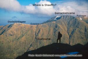
Where is Sheeffry?The Sheefry or Sheeffry Hills is a name heard now for a range of hills in Mayo extending eastwards from Doo Lough towards the wee village of Drummin.…
Mweelrea & The Reek Map to PrintAfter a long haul, I’m glad to say that our new Mweelrea & The Reek map at 1:25,000 scale is with the printer. It…
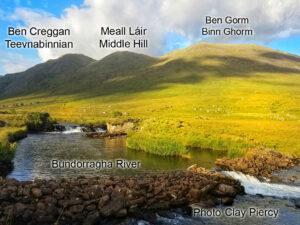
More Mayo Hills If you take the scenic road from Leenane around Killary, passing by Aasleagh Falls and on towards Delphi and Doolough, then you’ll pass these three hills on…
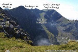
Hill Names around MweelreaOriginal mapping requires careful checking of placenames and who better to ask than those who live and make their livelihoods there. Mweelrea/ Muilrea was dealt with in…
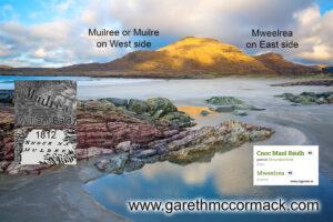
Mweelrea & Muilree I was discussing placenames with several local hill farmers last week in the Mweelrea area and was interested to hear their pronunciation of the name of this…
Formna There are a number of common words that apply to a hill in Ireland: Knock or Cnoc, Slieve or Sliabh, Ben or Binn, Crook or Cruach etc. Here’s one…
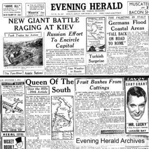
JB Malone and the Evening Herald (John Bernard) JB Malone (1913-89) was a prolific writer and promoter of hillwalking from the 1930s through to the 1970s. He did much for…
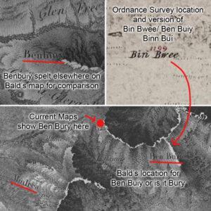
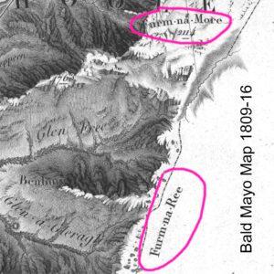
Ben Bury & William Bald A Scottish surveyor called William Bald surveyed an important map of Co.Mayo in the years 1809-16. It’s a very impressive and completely original work, surveyed…