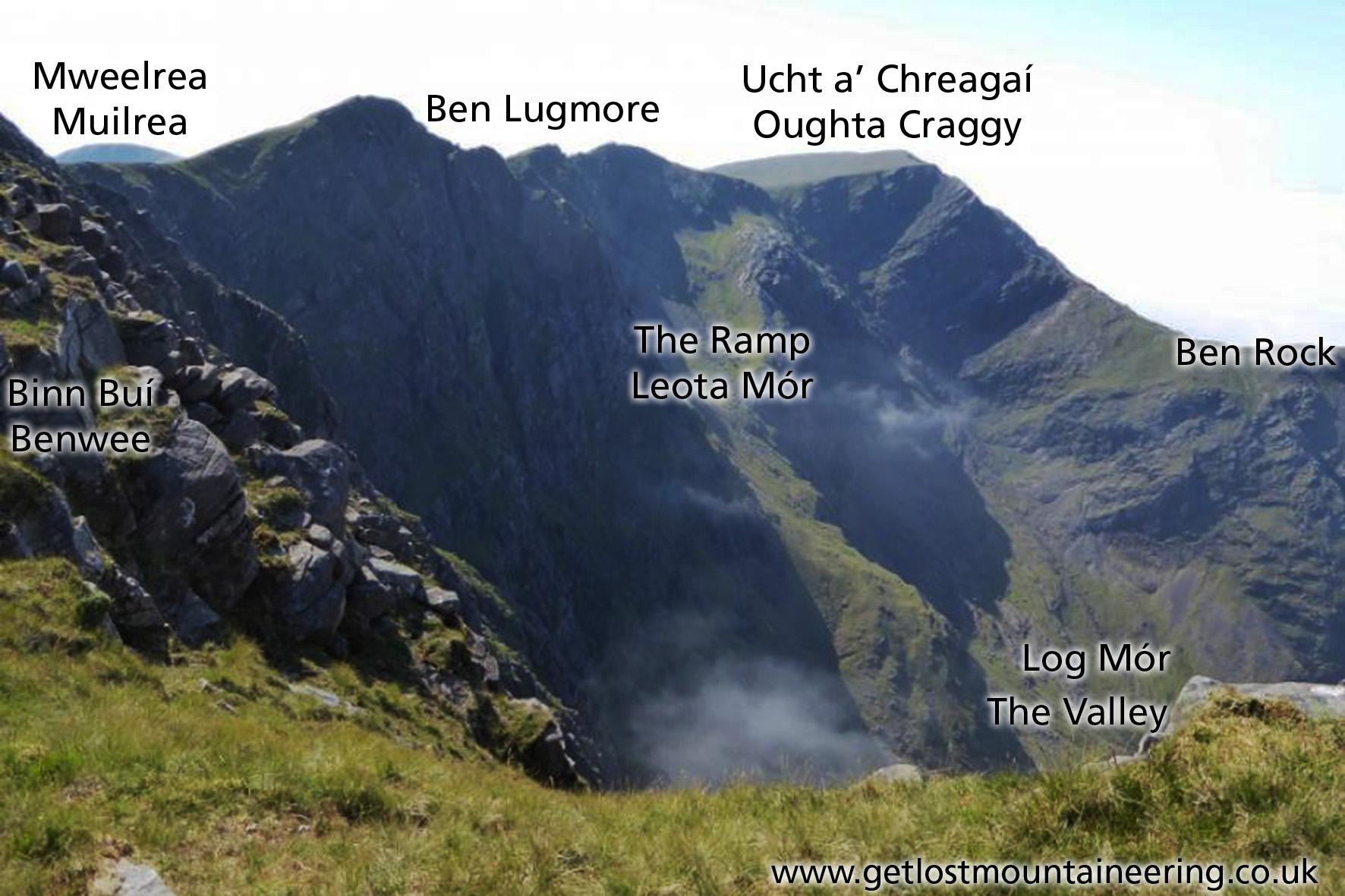
Hill Names around Mweelrea
Original mapping requires careful checking of placenames and who better to ask than those who live and make their livelihoods there. Mweelrea/ Muilrea was dealt with in a post a couple of weeks ago. Below is what I’ve heard/ deduced re other nearby hill names.
- Ben Bury is not known locally except as a ‘map name’. This height though is well known as Ucht a’ Chreagaí / Oughta Craggy. Where ‘creag’ relates to the rocky precipitous slopes. Whilst ‘ucht’ literally means a breast, it’s better thought of in placenames as a bosom or swelling – so the rocky swelling.
- Log Mór, the big hollow – name is not known locally now though recorded on old maps. It’s now simply known as The Valley.
- Ben Rock – rocky peak on NW side of The Valley / Log Mór. Subsidiary of Ucht a’ Chreagaí.
- Ben Lugmore, the peak of Log Mór is not known locally but is recorded on 19thC geological mapping and makes sense. No local name.
- Binn Buí, Benwee, Benboy – yellow, grassy peak is known locally. Applied to both a prominent spur and the height above. This is Bald’s Ben Buiy that the OS managed to mangle into Ben Bury and move 2kms away.
- The Ramp / Leota Mór – well known sloping grass terrace up back of The Valley / Log Mór. Known locally as the Ramp but hill farmers say Leota Mór is the name proper. ‘Leota’ is given as meaning a long, untidy or rough strip (of land), a description which fits well. When sheep were gathered off the high hills, they were/ are brought down Leota Mór to the Valley.
#eastwestmapping #mweelrea #mountainviews.ie #mayohillwalkers