
Connemara Map Update
Connemara Mountains Update
Connemara Mountains Update On our Connemara Mountains published earlier this year, I applied the name Mulnahogue to spot height 702 metres, the highest hill in the Maumturk range. This for…

Map Updates
Connemara Mountains Update On our Connemara Mountains published earlier this year, I applied the name Mulnahogue to spot height 702 metres, the highest hill in the Maumturk range. This for…
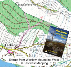
Lacken Mass Path update Customers and users of our Wicklow Mountains West map might like to take note of a useful update at Lacken, Co.Wicklow. The local community in the…
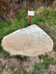
Raheenleagh Map Update Thanks to map user Alan Brooks who sent in a photo and note regarding a memorial stone that has been uncovered and now marked at Raheenleagh forest…
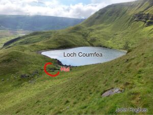
Thanks to customer and map user John Hughes for passing on details of a small hut site or sheep pen that was missing from our Comeragh 1:25,000 map. Here's John's…