Mass Rock in Glencree
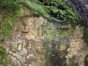
Mass rock in Glencree This large two metre high granite rock with religious carvings lies on the west bank of the Askabawn Stream that runs into the Glencree River. It…

Mass rock in Glencree This large two metre high granite rock with religious carvings lies on the west bank of the Askabawn Stream that runs into the Glencree River. It…
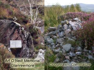
Art O'Neill's Grave The main photo here is of the Art O'Neill memorial found at the foot of the Flags of Glanree. According to the account in the Annals of…
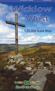
Art O'Neill Many people will recognise Art's Cross pictured on the cover of our map, Wicklow Mountains West. The cross itself was erected in 1932 to commemorate the escape of…
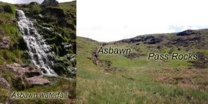
Pass to Glenmalure and the Asbawn Glanreemore and Glanreebeg are part of an old journey to Glenmalure from the Kings River valley. Nowadays people would drive around via Laragh but…
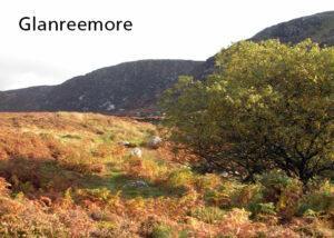
Glanreemore & Glanreebeg Liam Price considered that the name Unry was preserved in the name Glanree, which is one of the subsidiary valleys draining into the Kings River. This could…
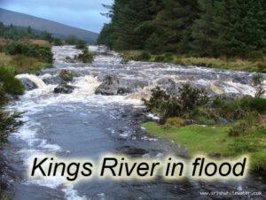
Kings River, West Wicklow The Kings River is a major tributary of the Liffey. It rises up near Wicklow Gap and flows down a broad valley terminating nowadays into Poulaphuca…
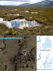
Pool & Hummock Terrain - a cartographic challenge I'm currently preparing a map of the Nephin Beg area in Co.Mayo - this will incorporate both the Wild Nephin project and…
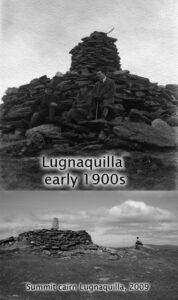
Percy's or Pierce's Table I have written on another post about the mountain Lugnaquilla when viewed from a distance. Here is a photo of the summit cairn, topped by a…
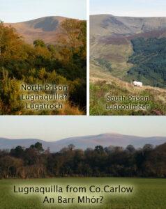
Lugnaquilla Lugnaquilla at 925 metres in altitude is the sixth highest mountain in Ireland and the highest point outside of Kerry. The name is thought to come from either Log…
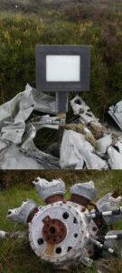
Leo O'Connor Aircrash The Dublin & Wicklow uplands sometimes cause problems for aircraft in poor weather. I can think of seven aircrash sites off top of my head but only…