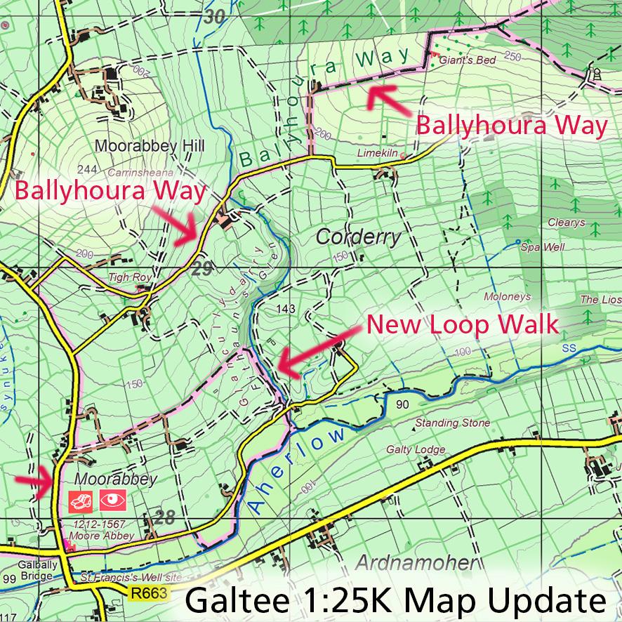
Galtee Map Update ~ Ballyhoura Way
If you have a copy of our 1:25,000 scale map of the Galtees, see the map extract here for details of a change to the Ballyhoura Way. So from Moore Abbey at Galbally Bridge to Ballinacourty Wood, the agreed route now goes north by road and then by a new path that runs by the Giant’s Bed megalithic tomb. There are fine views from this part of the route.
The loop walk that started from Moore Abbey has also been upgraded and extended. It now follows the Aherlow River in part, then climbs a wooded glen to return by a field path to the road – about 3 kilometres/ an hour in length. Again with fine views.
Thanks to Jimmy Barry of Aherlow Fáilte for passing on details of these changes.
#eastwestmapping #munstervales ##aherlowfailte