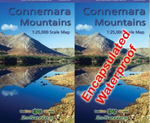
Connacht Map Set
If you’re planning on setting foot on the shores of Connemara or Achill this summer, this set of three detailed maps will be the perfect guide. The Connemara Mountains are…
Connemara Mountains Map
If you’re planning on setting foot on the shores of Connemara or Achill this summer, this set of three detailed maps will be the perfect guide. The Connemara Mountains are…
Connemara Mountains Update On our Connemara Mountains published earlier this year, I applied the name Mulnahogue to spot height 702 metres, the highest hill in the Maumturk range. This for…
Connemara Upland Fencing Whilst compiling detail for our Connemara Mountains, I was often struck by the dense network of modern upland fencing. Where older walls and fences bend to the…
Corcóg is a Hewitt The world of hill lists is mighty confusing with various differing lists in both imperial and metric measurements arranged by height. Munros are well enough known…
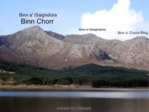
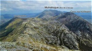
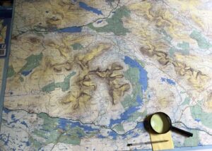
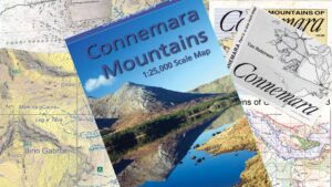
Placenames on the Connemara Mountains Map I’ve taken a different approach to the placename content of our new Connemara Mountains map. For other maps we’ve published I’ve devoted a fair…
Binn a' tSaighdiúra The astute user of maps of the Twelve Bens will be familiar with the name Binn a' tSaighdiúra and it’s location roughly halfway between Binn Chorr (Bencorr)…
Mulnahogue Thanks to everyone who has purchased our newly released Connemara Mountains map. It’s been well received to date and please continue to spread the word. https://eastwestmapping.ie/product/connemara-mountains/ I’ll deal with…
Connemara Mountains Map I’m happy to advise that our new Connemara Mountains 1:25,000 is now available. Covid19 has delayed publication by over two months but better late than never! Definitive…
Connemara Mountains Proof Just examining a printers proof of our new Connemara Mountains map whose production has been interrupted by Covid19 etc. Notwithstanding that self-praise is no praise, I can…