Map Update Queries
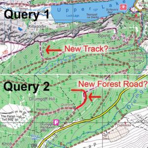
Map Update QueriesI’m currently making a round of updates to our mapping. Have a couple of queries which users may be able to shed light on. These are in relation…

EastWest Mapping Blog
Map Update QueriesI’m currently making a round of updates to our mapping. Have a couple of queries which users may be able to shed light on. These are in relation…
Future of Irish Mapping ~ EastWest MappingFinal part of a series on Irish Mapping: past, present & future.EastWest Mapping has been on the go for 30+ years, of which the…
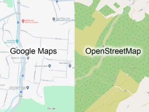
Future of Irish Mapping ~ Google & OpenStreetMapPart of a series on Irish Mapping: past, present & future.In our last post, I looked at the state mapping agency Tailte Éireann…
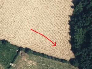
Creative CombineSpotted when plotting detail for a new Blackstairs & Mount Leinster map. Someone was feeling creative with the combine harvester obviously – a nice celtic type knot.#eastwestmapping #blackstairs_hiking

Future of Irish Mapping ~ Tailte ÉireannPart of a series on Irish Mapping: past, present & future.Tailte Éireann is a new state body formed from a merger of the property…
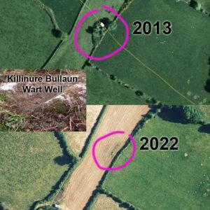
Changing Landscapes ~ Killinure Wart WellI first surveyed our Blackstairs & Mount Leinster map over 2012-13 and am currently recompiling the whole map from scratch to bring it to the…
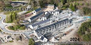
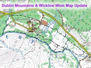
Changing Landscapes ~ Kippure EstateI posted a map update to Kippure Estate in Wicklow recently based on recreation developments of a few years ago. This same venue Kippure Estate/ Kippure…

Irish Map MarketThis piece is based on generalities but which nonetheless are worth considering. There have been & will always be those who appreciate good mapping, there are likewise those…
Kippure Estate UpdateTim & Della Kyne developed Kippure House into an adventure/ event/ conference centre back in the early 2000s. Called Kippure Estate it offered school tours, corporate days out,…
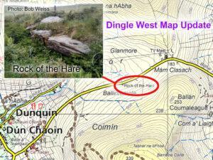
Rock of the Hare ~ Dingle West MapThanks to Bob Weiss for photo and information on this road side rock, apparently called the Rock of the Hare. It lies on…