Hiiker Map Updates
Hiiker Map UpdatesMaps from EastWest Mapping are found on the Hiiker phone app. Here we make annual updates around this time. By contrast updates don't appear in print for several…

Hiiker Map UpdatesMaps from EastWest Mapping are found on the Hiiker phone app. Here we make annual updates around this time. By contrast updates don't appear in print for several…
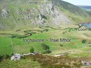
Inchavore ~ Inse MhórLough Dan is a popular place to visit in Wicklow. You need to walk in, either from the Pier Gates on the Roundwood side or from the…
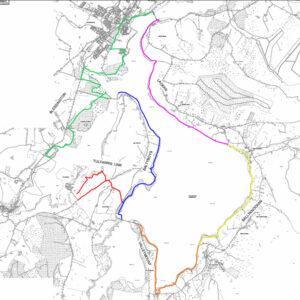
Blessington eGreenwayThe Blessington eGreenway proposal is back on track, new plans are viewable on the Wicklow County Council website and all is to go before An Bord Pleanála.Poulaphuca Reservoir was…
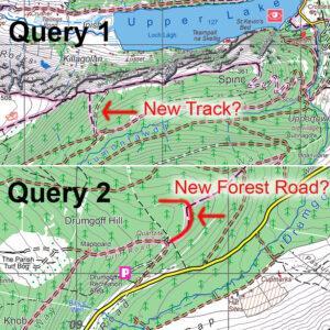
Map Update QueriesI’m currently making a round of updates to our mapping. Have a couple of queries which users may be able to shed light on. These are in relation…
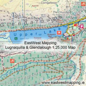
Future of Irish Mapping ~ EastWest MappingFinal part of a series on Irish Mapping: past, present & future.EastWest Mapping has been on the go for 30+ years, of which the…
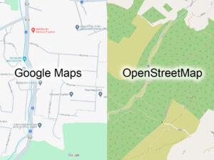
Future of Irish Mapping ~ Google & OpenStreetMapPart of a series on Irish Mapping: past, present & future.In our last post, I looked at the state mapping agency Tailte Éireann…
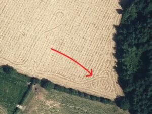
Creative CombineSpotted when plotting detail for a new Blackstairs & Mount Leinster map. Someone was feeling creative with the combine harvester obviously – a nice celtic type knot.#eastwestmapping #blackstairs_hiking

Future of Irish Mapping ~ Tailte ÉireannPart of a series on Irish Mapping: past, present & future.Tailte Éireann is a new state body formed from a merger of the property…
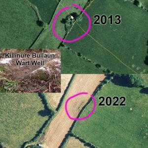
Changing Landscapes ~ Killinure Wart WellI first surveyed our Blackstairs & Mount Leinster map over 2012-13 and am currently recompiling the whole map from scratch to bring it to the…
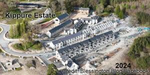
Changing Landscapes ~ Kippure EstateI posted a map update to Kippure Estate in Wicklow recently based on recreation developments of a few years ago. This same venue Kippure Estate/ Kippure…