Other Map Publishers: Harvey
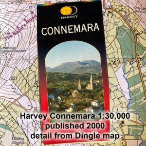
Other Map Publishers: HarveyPart five of a short series on Irish Mapping: past, present & future.As far as small & medium scale mapping in Ireland goes, two map publishers have…

Other Map Publishers: HarveyPart five of a short series on Irish Mapping: past, present & future.As far as small & medium scale mapping in Ireland goes, two map publishers have…
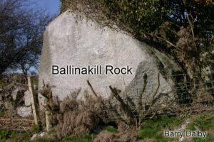
Ballinakill RockWhilst compiling new detail for a complete overhaul of our Blackstairs & Mount Leinster map, I came across the site again of the Ballinakill Rock. This is a large…
Ordnance Survey This CenturyPart four of a short series on Irish Mapping: past, present & future.The Ordnance Survey in Ireland was set up on the foot of the Spring Rice…
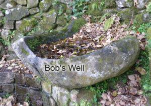
Bob's WellThis is Bob’s Well, a granite bowl that collects water where you could get a sup. This would have been for the relief of estate workers on the Coollattin…
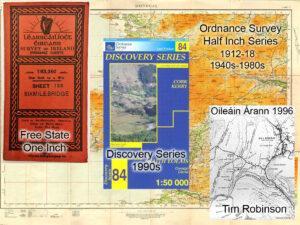
Ordnance Survey 20th CenturyPart three of a short series on Irish Mapping: past, present & future.The first twenty years of the 20thC saw the Ordnance Survey continue to be run…
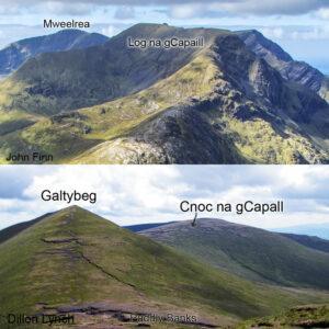
Horsey HillnamesCapall - one of the Irish words for a horse crops up quite frequently in our placenames. No doubt but that in some places, it literally means a place…
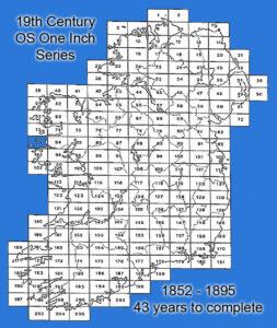
Ordnance Survey 19th CenturyPart two of a short series on Irish Mapping: past, present & future.The century opened with the Act of Union and a relatively quiet period on the…
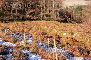
CornagrusCornagrus is an isolated graveyard with a certain amount of mystery attached. It's located on a hillside west of Wicklow Gap, in Knocknadroose, a little less than a kilometre from…
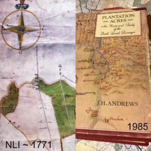
Early Irish Surveyors – the Golden AgePart one of a short series on Irish Mapping: past, present & future.People are generally unaware of the prolific works of numerous Irish land…
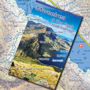
Doo Lough NamesThe fine photo on the cover of the new map of Mweelrea & The Reek was taken by John Finn of Cork and captured from the slopes of…