Silsean ~ Shileshawn
Silsean ~ Shileshawn We're always happy to hear from people who have information on local placenames and/or who spot errors on our maps. The one topic that I receive most…

Wicklow West Map
Silsean ~ Shileshawn We're always happy to hear from people who have information on local placenames and/or who spot errors on our maps. The one topic that I receive most…
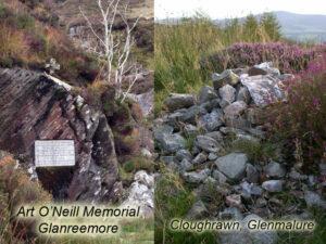
Art O'Neill's Grave The main photo here is of the Art O'Neill memorial found at the foot of the Flags of Glanree. According to the account in the Annals of…
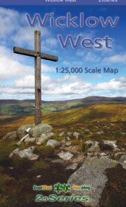
Art O'Neill Many people will recognise Art's Cross pictured on the cover of our map, Wicklow Mountains West. The cross itself was erected in 1932 to commemorate the escape of…
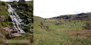
Pass to Glenmalure and the Asbawn Glanreemore and Glanreebeg are part of an old journey to Glenmalure from the Kings River valley. Nowadays people would drive around via Laragh but…
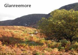
Glanreemore & Glanreebeg Liam Price considered that the name Unry was preserved in the name Glanree, which is one of the subsidiary valleys draining into the Kings River. This could…
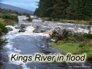
Kings River, West Wicklow The Kings River is a major tributary of the Liffey. It rises up near Wicklow Gap and flows down a broad valley terminating nowadays into Poulaphuca…
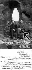
Charles Thompson (CGT) - science teacher, mountaineer and collector of place names A good number of placenames in Wicklow have been added to our maps in the past year. Some…
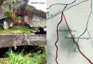
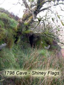
Burke's Cave One of the interesting aspects of examining old maps is that they often show long gone features from the past, particularly in urban areas. However due to the…
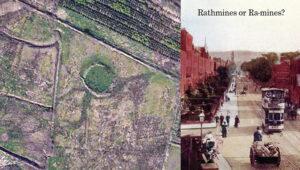
Raths and Raws The rath or ringfort is a ubiquitous feature in the Irish landscape - there are thought to be 40,000 plus sites. These circular enclosures were used as…
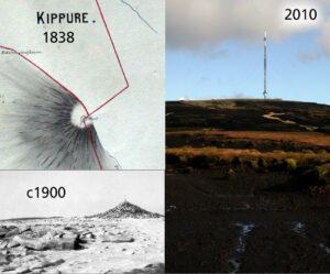
Kippure - The Pole Kippure is a townland and also the name given to the highest mountain in Co.Dublin at 757 metres in altitude. Straddling the Dublin/Wicklow border, it is…