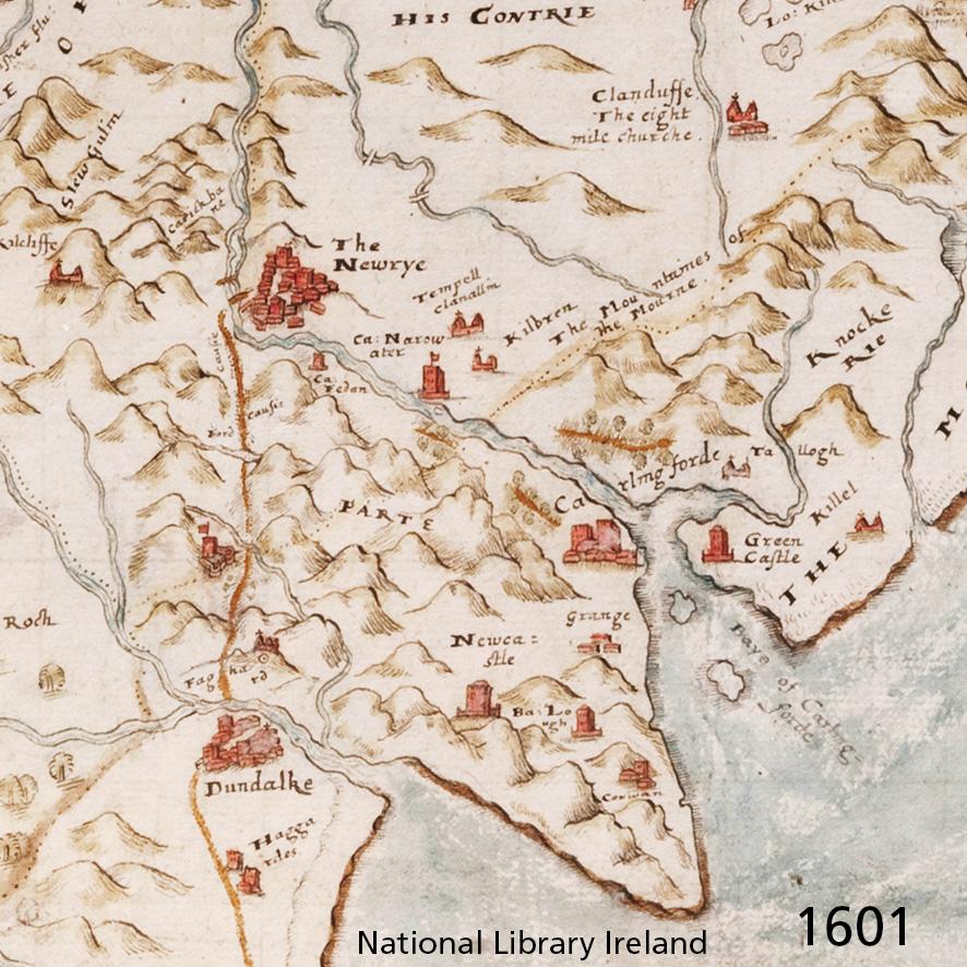
Cooley 1601
An early & interesting map of Cooley & Mourne districts. Dated 1601, there are numerous hills marked on the lands south of Newrye. If anything, the Cooley peninsula appears more mountainous than the district of Mourne to the north & east.
Note the Baye of Carlingforde and waters leading to Newry and likewise the inlet of Dundalk Bay are both well represented. This map represents the maritime importance of this region with the impression of the hills of Cooley as seen from the sea. Even though it must have been obvious that Mourne was higher and more mountainous, that region just didn’t have the same importance.
#eastwestmapping #cooleypeninsulaundiscovered